Cho La Pass, Nepal: Complete Travel & Trekking Guide
By Nepal Trip Services On 08 Oct 2026

By Nepal Trip Services On 08 Oct 2026

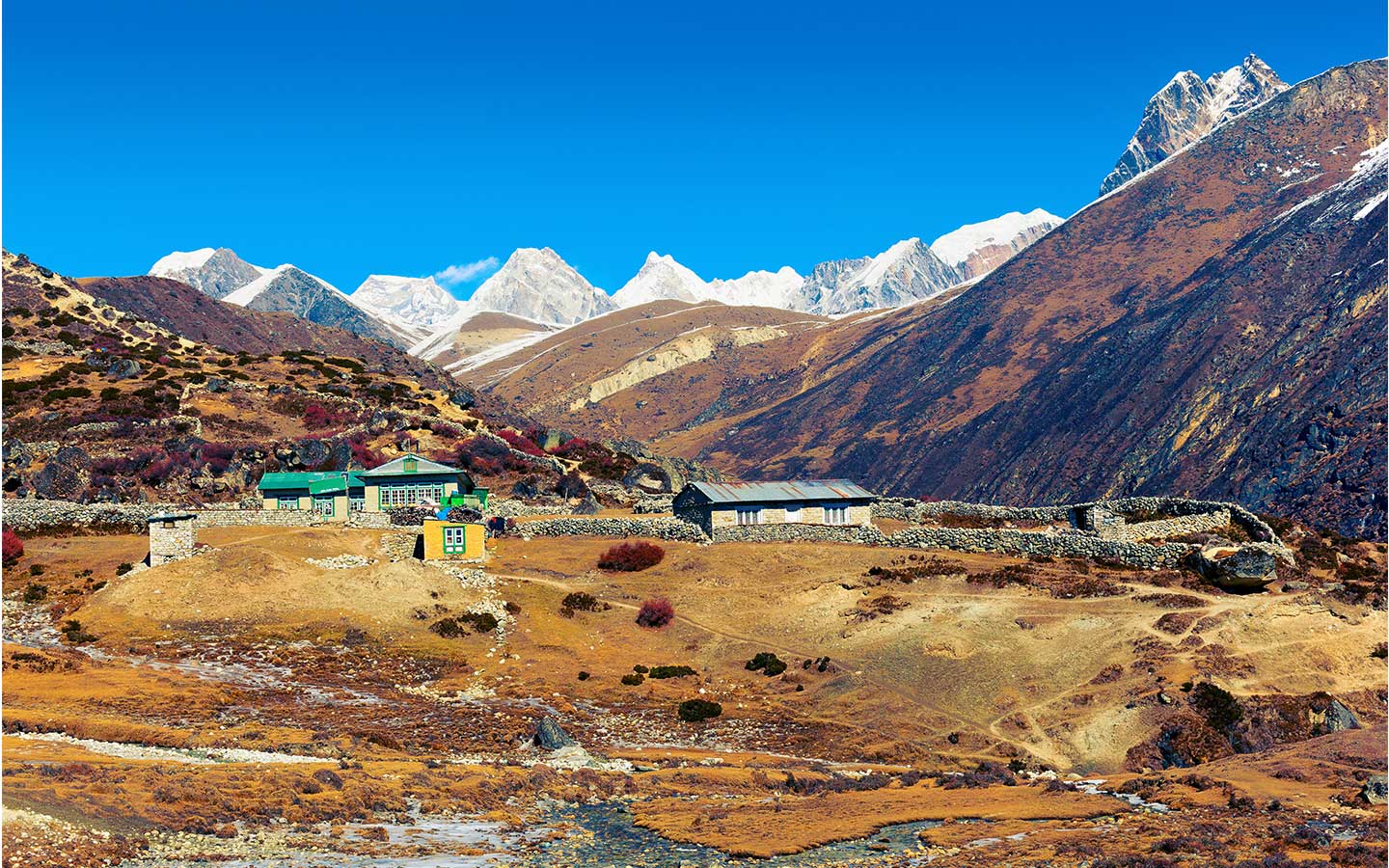
Cho La Pass (5,420 m / 17,782 ft) is a dramatic high pass in Nepal's Everest (Khumbu) region that links the Everest Base Camp valley with the turquoise lakes of Gokyo. It is the only pass on the Three Passes circuit with a glacier to cross near the top, and its prayer-flagged summit looks out over Cholatse, Ama Dablam, Lobuche East and Baruntse. For many trekkers, Cho La is the most adventurous and memorable day in the Khumbu.
Most trekkers cross Cho La as the second pass on the Everest Three High Passes Trek, after Kongma La and before Renjo La. Others use it to combine Everest Base Camp and the Gokyo Lakes in one journey. It is a demanding 7–8 hour day with a steep boulder scramble, an icy glacier traverse and a long rocky descent, but the reward is one of the finest mountain landscapes in Nepal.
This guide covers everything you need to know: location, route, difficulty, best time, permits, acclimatisation, teahouses, packing and expert tips, followed by the 15 questions trekkers ask most.
|
Detail |
Information |
|---|---|
|
Altitude |
5,420 m (17,782 ft) |
|
Location |
Khumbu region, Sagarmatha National Park, Solukhumbu District, Nepal |
|
Connects |
Dzongla (4,830 m), Khumbu Valley → Thangnak (4,700 m), Gokyo Valley |
|
Crossing time |
7–8 hours |
|
Distance |
About 10 km |
|
Height gain / loss |
About 590 m up / 720 m down |
|
Difficulty |
Strenuous; the most technical of the Three Passes |
|
Special feature |
Short glacier crossing near the top |
|
Technical skills |
None, but microspikes are essential when icy |
|
Best seasons |
Late September–November and April–May |
|
Main views |
Cholatse, Ama Dablam, Lobuche East, Baruntse, Taboche, Cho La glacier |
|
Permits |
Sagarmatha National Park + Khumbu Pasang Lhamu Rural Municipality |
|
Trek that includes it |
Everest Three High Passes Trek – 19 Days, from US$ 1,450 per person |
Cho La sits in the heart of Sagarmatha National Park, a UNESCO World Heritage Site in northeastern Nepal. The pass crosses the high ridge between Cholatse (6,440 m) and Lobuche East, connecting two of the Khumbu's most famous valleys:
Without Cho La, travelling between these two valleys means walking all the way down to Phortse and back up, which takes 3–4 extra days.
Cho La can only be reached on foot after flying to Lukla and acclimatising gradually for a week or more.
|
Trek |
Duration |
Cho La role |
Best for |
|---|---|---|---|
|
19 days |
Second pass (anticlockwise), Dzongla → Thangnak |
Fit, experienced trekkers |
|
|
EBC + Gokyo via Cho La (custom) |
15–17 days |
Links Everest Base Camp with the Gokyo Lakes |
Trekkers wanting both highlights without three passes |
|
Gokyo + Cho La + EBC (clockwise, custom) |
15–17 days |
Crossed from Thangnak to Dzongla after Gokyo |
Trekkers who prefer Gokyo first |
Compare all options on our Everest Region Treks page, or extend the Gokyo Lakes Trek or Classic Everest Base Camp Trek with Cho La through our trip planner.
Pass day starts early. Most groups leave Dzongla between 4:30 and 5:30 AM with headlamps, so they reach the glacier while the snow is firm and cross before afternoon wind and cloud roll in. Here is how the day typically unfolds on the anticlockwise route.
|
Stage |
Approx. time |
Altitude |
What to expect |
|---|---|---|---|
|
Dzongla → upper valley |
1–1.5 hrs |
4,830 → ~5,000 m |
Gentle climb up a grassy, then rocky valley beneath Cholatse |
|
Boulder field & steep scramble |
1.5–2 hrs |
~5,000 → ~5,300 m |
The toughest climb: large boulders and loose rock, sometimes using hands for balance |
|
Cho La glacier traverse |
30–60 mins |
~5,300 → 5,420 m |
Gently sloping glacier; can be icy and slippery; microspikes on |
|
On the pass |
15–30 mins |
5,420 m |
Prayer flags, photos and a snack with sweeping mountain views |
|
Steep descent (west side) |
1.5–2 hrs |
5,420 → ~5,000 m |
Steep, loose rock and scree; slow, careful steps |
|
Valley walk to Thangnak |
1–1.5 hrs |
~5,000 → 4,700 m |
Easier trail through a boulder-strewn valley |
|
Total |
7–8 hrs |
~590 m up, ~720 m down |
About 10 km |
The glacier on the eastern side of the pass is what makes Cho La unique. In good conditions, it is a gentle, mostly flat walk of 30–60 minutes on snow and ice, with a well-trodden path. Early in the morning, after fresh snowfall, or in late autumn and winter, it can be hard and slippery. Microspikes, trekking poles and following your guide's line closely make the crossing safe. Crevasses are not usually a concern on the standard route, but always stay on the marked track.
From Thangnak (also called Dragnag), a short 2–3 hour walk crosses the Ngozumpa Glacier, Nepal's longest at about 36 km, to reach Gokyo village on the shore of Dudh Pokhari. The route over the glacier's rubble changes every season, so follow your guide closely.
On the clockwise route, trekkers cross Cho La from the Gokyo side. The climb up the western side is shorter but much steeper, on loose rock and scree, and the glacier comes as a descent toward Dzongla. Both directions are possible. Most operators, including Nepal Trip Services, prefer the anticlockwise direction on the Three Passes for more gradual acclimatisation.
Cho La is graded strenuous and is widely considered the most technical of the Everest Three Passes, though not the highest. It needs no ropes or climbing skills, but it combines high altitude, a steep boulder scramble, a glacier crossing and a long, loose descent.
What makes Cho La challenging:
|
Factor |
Cho La |
Kongma La |
Renjo La |
|---|---|---|---|
|
Altitude |
5,420 m |
5,535 m |
5,360 m |
|
Route |
Dzongla → Thangnak |
Chhukung → Lobuche |
Gokyo → Lungden |
|
Crossing time |
7–8 hrs |
8–9 hrs |
7–8 hrs |
|
Main challenge |
Glacier, boulders, steep descent |
Length, altitude, Khumbu Glacier |
Long stone staircase and descent |
|
Glacier on the pass |
Yes |
No (Khumbu Glacier below) |
No |
|
Best view |
Cholatse and Ama Dablam |
Makalu and Imja lakes |
Everest above the Gokyo Lakes |
|
Difficulty |
Most technical |
Hardest overall |
Easiest |
By the time you reach Dzongla on the anticlockwise route, you have already slept above 5,000 m at Gorak Shep and climbed Kala Patthar, so you are usually well acclimatised. Even so, altitude sickness remains a serious risk.
Microspikes are lightweight chains with small steel spikes that stretch over your boots, giving grip on ice and hard snow. They are the single most important piece of gear for Cho La.
|
Detail |
Information |
|---|---|
|
Why you need them |
Icy glacier traverse and frozen boulders near the top |
|
Crampons needed? |
Usually no; microspikes are enough unless snow is very heavy |
|
Where to get them |
Buy or rent in Thamel (Kathmandu) or rent in Namche Bazaar |
|
Weight |
About 300–400 g per pair |
|
How to use |
Fit before the ice, walk flat-footed with short steps, remove on bare rock |
The best months for Cho La are mid-October to November and late April to May, when the glacier is usually in good condition and the weather is stable.
|
Season |
Months |
Pass & glacier conditions |
Day / night temp near the pass |
Verdict |
|---|---|---|---|---|
|
Autumn |
Late Sep–Nov |
Dry and clear; glacier firm but can be icy in the mornings |
0 to 10°C / -10 to -18°C |
Best |
|
Spring |
Late Mar–May |
Old snow early; better by late April and May |
3 to 12°C / -8 to -15°C |
Excellent |
|
Winter |
Dec–Feb |
Deep snow and hard ice; pass often closed |
-8 to 3°C / -20 to -30°C |
Not recommended |
|
Monsoon |
Jun–Aug |
Rain, fog, poor visibility and slippery rock |
5 to 12°C / -2 to -8°C |
Not recommended |
Temperatures are approximate; wind on the pass makes it feel much colder.
Seasonal tips:
No special permit is needed for Cho La itself. The two standard Everest-region permits cover the whole route.
|
Permit |
Fee for foreign nationals |
Where checked |
|---|---|---|
|
Sagarmatha National Park Entry Permit |
NPR 3,000 + 13% VAT |
Monjo |
|
Khumbu Pasang Lhamu Rural Municipality Permit |
NPR 3,000 |
Lukla |
A TIMS card is not required in the Everest region. Both permits are included in our trek packages.
|
Group size |
Price per person |
|---|---|
|
1 person |
US$ 1,600 |
|
2 people |
US$ 1,500 |
|
3–6 people |
US$ 1,480 |
|
7–10 people |
US$ 1,450 |
The Everest Three High Passes Trek package includes Lukla flights, permits, a licensed guide, porters, teahouses and three meals a day on the trek. Budget around US$ 20–30 per day extra for hot drinks, showers, charging and Wi-Fi. Microspikes can be rented in Thamel or Namche for a small fee.
|
Stop |
Altitude |
Teahouse standard |
Notes |
|---|---|---|---|
|
Lobuche |
4,940 m |
Basic |
Busy lodges on the main EBC trail |
|
Dzongla |
4,830 m |
Very basic |
A few small lodges below Cholatse; book ahead in peak season |
|
Thangnak (Dragnag) |
4,700 m |
Very basic |
Small lodges beside the Ngozumpa Glacier |
|
Gokyo |
4,790 m |
Basic–good |
Lakeside lodges with views of Dudh Pokhari |
Your porter carries the main duffel, but everything you need for 7–8 hours above 5,000 m must be in your own 30–40 L daypack.
|
Category |
Essentials |
|---|---|
|
Traction |
Microspikes (essential), trekking poles, gaiters (optional) |
|
Warmth |
Down jacket (rated -20°C), fleece, thermal base layers, windproof shell jacket and trousers |
|
Head & hands |
Warm beanie, buff, liner gloves + insulated waterproof gloves, Category 3–4 glacier sunglasses |
|
Footwear |
Broken-in waterproof boots with ankle support and good grip |
|
Food & water |
2–3 litres in insulated bottles, packed lunch from Dzongla, energy bars, nuts, chocolate, electrolytes |
|
Safety |
Headlamp with spare batteries, personal first-aid kit, blister plasters, altitude medication (on doctor's advice) |
|
Sun protection |
SPF 50+ sunscreen and lip balm; snow glare on the glacier is intense |
|
Extras |
Power bank, camera, toilet paper, small rubbish bag |
Cho La's glacier and alpine valleys are fragile and visibly affected by climate change. Help keep them clean:
Cho La is a high mountain pass in Nepal's Everest (Khumbu) region that connects Dzongla, near Everest Base Camp, with Thangnak and Gokyo in the Gokyo Valley. At 5,420 m, it is the second-highest of the Everest Three High Passes and the only one with a glacier crossing near the top. "La" means pass in the Sherpa and Tibetan languages.
Cho La stands at 5,420 m (17,782 ft). That is about 56 m higher than Everest Base Camp (5,364 m), slightly lower than Kongma La (5,535 m) and higher than Renjo La (5,360 m).
Cho La lies in Sagarmatha National Park, Solukhumbu District, northeastern Nepal. It crosses the ridge between Cholatse and Lobuche East, linking the Khumbu Valley (Lobuche, Gorak Shep, EBC) with the Gokyo Valley (Ngozumpa Glacier, Gokyo Lakes).
Most trekkers need 7–8 hours from Dzongla to Thangnak, covering about 10 km with roughly 590 m of ascent and 720 m of descent. Gokyo is a further 2–3 hours the next day, across the Ngozumpa Glacier.
Yes. Cho La is graded strenuous. It involves a steep boulder scramble, a glacier traverse that can be icy and a steep, loose descent, all above 5,000 m. Kongma La is longer and higher, but Cho La is usually considered the most technical of the three passes.
No technical climbing skills, ropes or harnesses are needed. Microspikes are essential when the glacier is icy, and they are usually enough. Full crampons are only needed in very heavy snow, when the pass is often closed anyway.
Cho La is not ideal for complete beginners. It suits fit trekkers with previous high-altitude experience. Well-prepared first-timers can cross it with 8–12 weeks of training, a properly acclimatised itinerary and an experienced guide who knows the glacier route.
The best months are mid-October to November and late April to May, when the weather is stable and the glacier is usually in good condition. In winter, snow and ice often close the pass, and in the monsoon, rain and fog make it slippery and dangerous.
Yes. A small glacier lies on the eastern side just below the summit. Crossing it takes 30–60 minutes on a gentle slope, but it can be slippery early in the morning or after snowfall, so microspikes and careful walking are important.
Most trekkers cross from Dzongla to Thangnak (east to west), as part of the anticlockwise Three Passes route. This gives better acclimatisation, since you have already been to EBC and Kala Patthar. The western side is steeper, so the clockwise direction means a harder climb.
No. There are no teahouses or shelters on the pass. The nearest lodges are in Dzongla (4,830 m) on the east side and Thangnak (4,700 m) on the west side. Carry water, a packed lunch and warm layers.
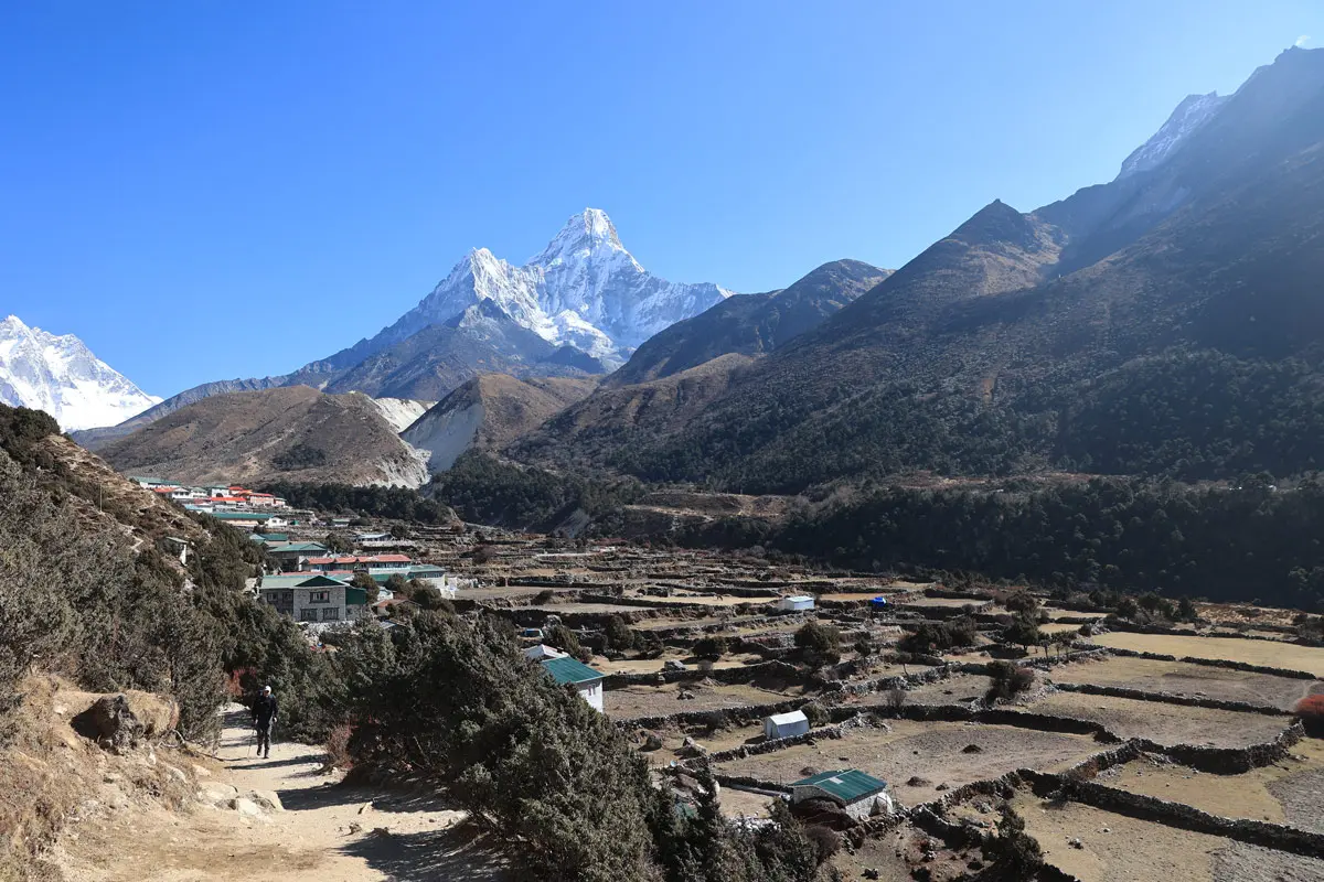
From the prayer-flagged summit, you see Cholatse towering above, Ama Dablam, Taboche, Lobuche East and Baruntse. On the approach from Lobuche, you pass the turquoise Chola Tsho lake, and on the descent, the rugged Gokyo Valley opens below.
Heavy snow can make Cho La unsafe. In that case, your guide will take an alternative route: descending via Pheriche and Phortse and climbing back up the Gokyo Valley through Dole and Machhermo. This adds 3–4 days, so build buffer days into your schedule.
A licensed guide is strongly recommended, and guided trekking is now the standard in Nepal. The glacier route changes each season, snow can hide the trail and conditions shift quickly. An experienced guide handles navigation, pacing, turnaround decisions and emergency support.
Cho La is included in our Everest Three High Passes Trek, a 19-day circuit from US$ 1,450 per person. You can also add Cho La to a Gokyo Lakes Trek or Classic Everest Base Camp Trek. Contact Nepal Trip Services or use our trip planner to design your route.
Cho La is where the Everest region feels most like a true mountain expedition. You scramble up boulders beneath Cholatse, walk across a gleaming glacier at dawn and stand among prayer flags at 5,420 m, with Everest Base Camp behind you and the turquoise Gokyo Lakes ahead. It is the link that turns two great treks into one unforgettable journey.
Crossing Cho La safely comes down to the right season, solid acclimatisation and an experienced team. With 16 years in the Himalayas, Nepal Trip Services takes care of every detail:
Ready to cross Cho La? Explore the full itinerary, inclusions and group prices on our Everest Three High Passes Trek – 19 Days page. For other routes, see all our Everest Region Treks, or plan a custom trip combining Everest Base Camp and Gokyo via Cho La. Spring and autumn departures fill quickly, so we recommend booking 2–3 months ahead.
Altitudes, timings, permit fees and prices are approximate and current as of October 2026. Conditions on Cho La change with weather and season; your guide will make the final call on the day.
Discover more articles that match your interests! Explore these similar blogs packed with insights, tips, and stories to keep you inspired.
Cross Kongma La Pass (5,535 m), the highest of Everest\\\'s Three Passes: route, difficulty, best time, permits, Chhukun...
Cross Renjo La Pass (5,360 m) from Gokyo to Lungden: best Everest view, route, difficulty, best time, permits, teahouses...
Explore Pangboche, the oldest monastery village in the Khumbu: yeti relics, Ama Dablam Base Camp hike, route, best time,...
How hard is the Everest Three High Passes Trek? Altitude, daily hours, pass-by-pass difficulty, fitness, training tips a...
Find the best time for the Everest Three High Passes Trek: month-by-month weather, pass conditions, temperatures, crowds...
Plan your stay in Dzongla (4,830 m), the last stop before Cho La Pass: route from Lobuche, Chola Tsho lake, teahouses, b...