Gokyo Ri, Nepal: Complete Travel & Trekking Guide
By Nepal Trip Services On 01 Oct 2026
By Nepal Trip Services On 01 Oct 2026
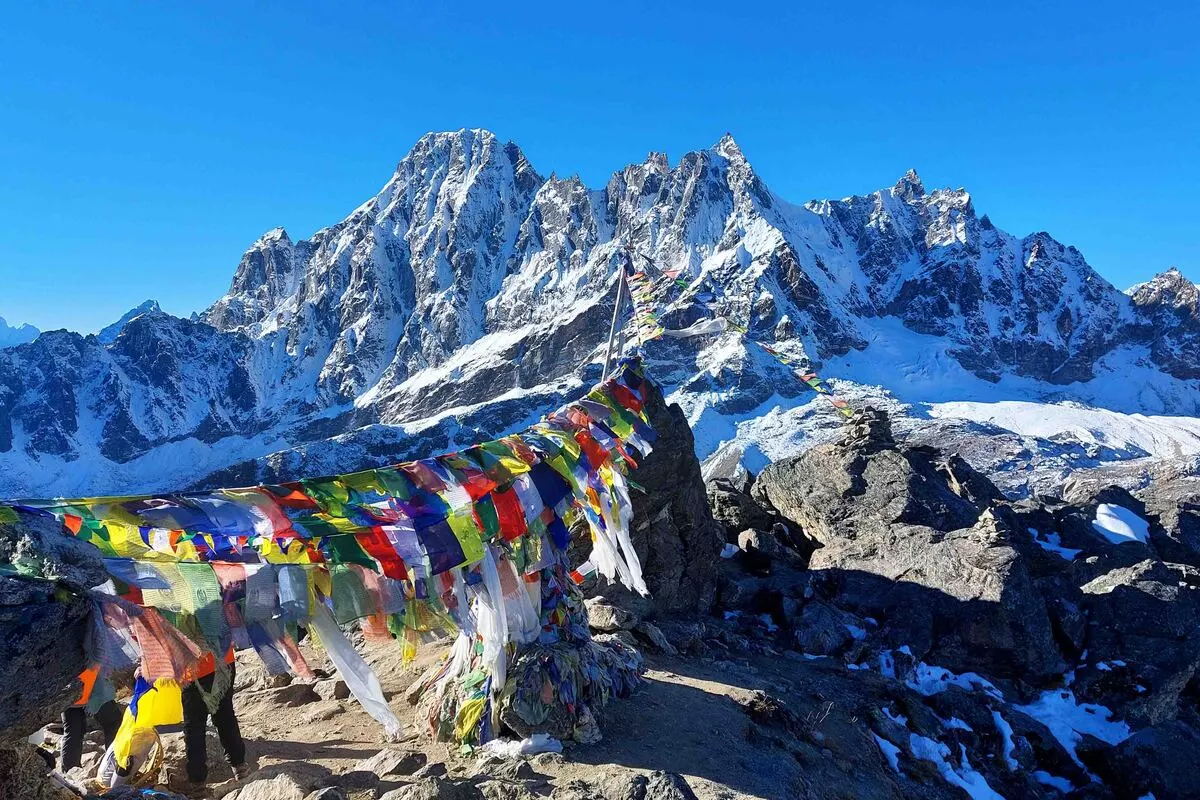
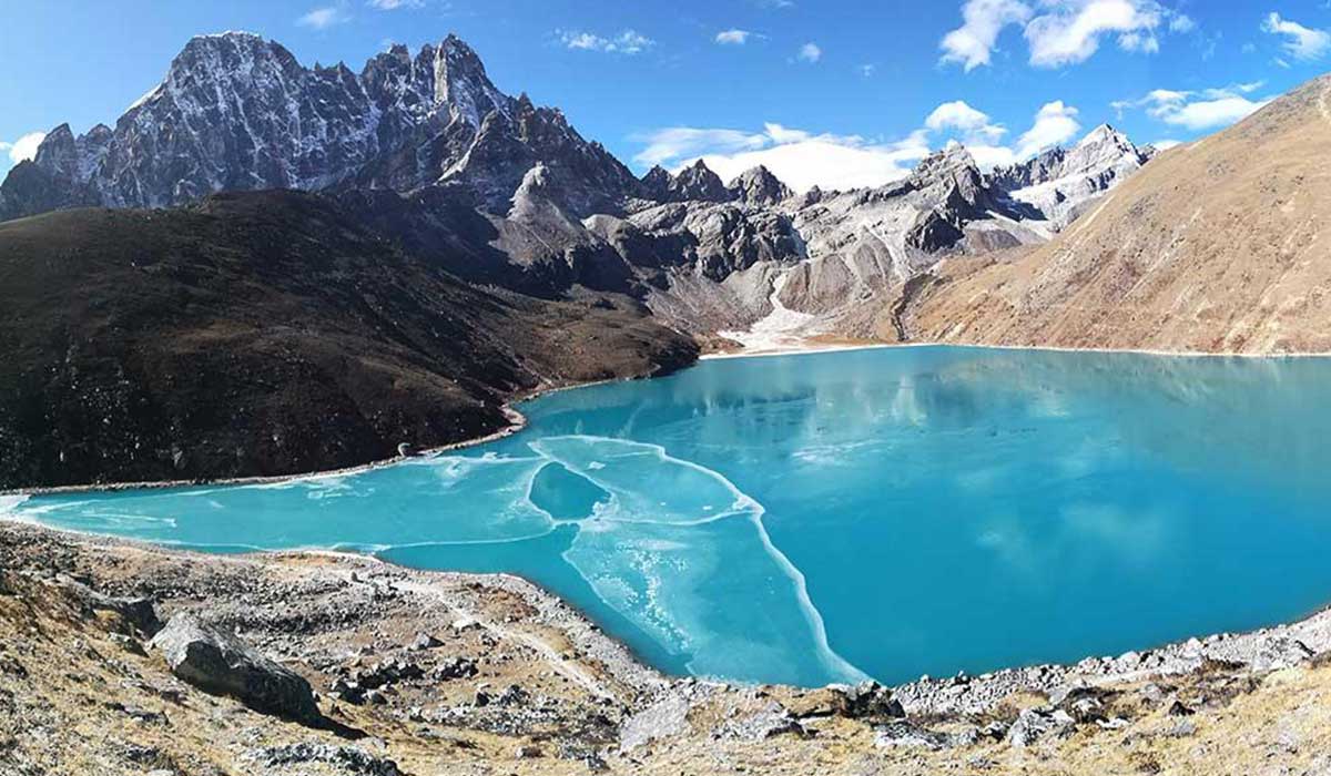
It starts with a narrow stone path leading away from the shore of a turquoise lake. Step by step, switchback after switchback, you climb a steep, rocky hillside as the air grows thinner and the lake shrinks below you. Then, after a final push past fluttering prayer flags, you reach the top, and the entire Himalaya seems to open before you. Everest, Lhotse, Makalu and Cho Oyu rise in one sweeping panorama, while the vast Ngozumpa Glacier and the glowing Gokyo Lakes lie at your feet. This is Gokyo Ri, one of the greatest mountain viewpoints on Earth. This complete guide from Nepal Trip Services covers everything you need to know about climbing Gokyo Ri: the route, difficulty, best time, views, safety tips and how to plan your adventure on our Gokyo Lakes Trek.
Gokyo Ri is a 5,357-metre peak rising directly above Gokyo village and the Third Gokyo Lake (Dudh Pokhari) in the Gokyo Valley of Sagarmatha National Park. In the Sherpa language, ri means "mountain" or "hill", so Gokyo Ri simply means "Gokyo Mountain".
It's not a technical climb but a steep trekking peak that requires no ropes or mountaineering skills. Its summit is the highest point on the standard Gokyo Lakes Trek and is famous for offering one of the most complete panoramas of the Everest region.
| Detail | Information |
|---|---|
| Location | Gokyo Valley, Sagarmatha National Park, Solukhumbu, Nepal |
| Summit Altitude | 5,357 m (17,575 ft) |
| Starting Point | Gokyo village (~4,790 m) |
| Elevation Gain | About 550–570 m |
| Distance | About 3–4 km round trip |
| Ascent Time | 2–3 hours |
| Descent Time | 1–1.5 hours |
| Difficulty | Challenging (due to altitude) |
| Technical Skills | None required |
| 8,000 m Peaks Visible | Everest, Lhotse, Makalu, Cho Oyu |
| Best Time to Climb | Early morning (sunrise) or late afternoon |
| Best Season | March–May & September–November |
Altitude note: Most sources list Gokyo Ri at 5,357 m, though you may also see 5,360 m on some maps.
Many trekkers and photographers consider Gokyo Ri's view even better than Kala Patthar, because it combines giant peaks, sparkling lakes and a massive glacier in one frame.
| Mountain | Height | Direction | Highlight |
|---|---|---|---|
| Cho Oyu | 8,188 m | North | World's 6th highest, towering over the valley |
| Gyachung Kang | 7,952 m | North-East | Massive peak between Cho Oyu and Everest |
| Mount Everest | 8,849 m | East | World's highest peak, with its summit pyramid clearly visible |
| Lhotse | 8,516 m | East | World's 4th highest, beside Everest |
| Nuptse | 7,861 m | East | Sharp ridge in front of Everest |
| Makalu | 8,485 m | South-East | World's 5th highest, distinctive pyramid shape |
| Cholatse & Taboche | ~6,440–6,500 m | South-East | Dramatic peaks above the valley |
| Kangtega & Thamserku | 6,783 m / 6,623 m | South | Iconic Khumbu peaks |
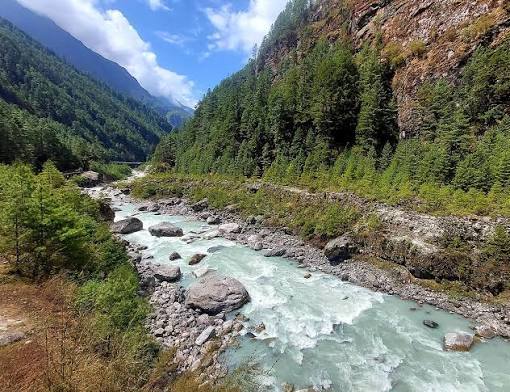
The trail begins at the northern edge of Dudh Pokhari, crossing the stream that flows into the lake on stepping stones or a small bridge.
From the lakeshore, the path climbs steeply up the hillside in a series of switchbacks. The trail is well-trodden but rocky and loose in places. Take slow, steady steps and rest often.
As you climb, several ridges appear to be the top. Keep going; the true summit is marked by colourful prayer flags and stone cairns.
At 5,357 m, the summit opens into a wide, rocky area with space to sit and enjoy the views. Find a sheltered spot out of the wind, take photos and soak in the panorama.
The return to Gokyo takes about 1–1.5 hours. Use trekking poles and watch your footing on loose gravel.
| Option | Pros | Cons |
|---|---|---|
| Sunrise Climb | Clearest skies, calm air, golden light on Cho Oyu and the lakes | Very cold (often -10°C to -20°C), early start around 4:00 AM, Everest is backlit |
| Afternoon / Sunset Climb | Warmer temperatures, soft light directly on Everest and Makalu | Higher chance of clouds, especially in spring |
| Season | Sunrise | Leave Gokyo |
|---|---|---|
| Spring | 5:15 – 6:00 AM | 3:00 – 4:00 AM |
| Autumn | 5:30 – 6:15 AM | 3:30 – 4:15 AM |
| Winter | 6:30 – 6:50 AM | 4:15 – 4:45 AM |
On our trek: Our itinerary includes an afternoon climb on Day 7, when sunlight falls beautifully on Everest. If you'd prefer a sunrise climb, your guide can adjust plans on Day 8 depending on weather and your energy.
| Factor | Details |
|---|---|
| Altitude | 5,357 m, the highest point of the trek |
| Steepness | Steep, sustained climb of 2–3 hours |
| Terrain | Rocky, sometimes loose gravel path |
| Weather | Cold, windy summit conditions |
| Technical Skills | None needed |
| Overall | Physically challenging but achievable with acclimatisation |
The main challenge is altitude, not technical difficulty. With proper acclimatisation in Namche, Dole and Machhermo, most fit trekkers reach the summit successfully.
| Feature | Gokyo Ri | Kala Patthar |
|---|---|---|
| Altitude | 5,357 m | ~5,545 m |
| Starting Point | Gokyo (~4,790 m) | Gorak Shep (~5,160 m) |
| 8,000 m Peaks Visible | Everest, Lhotse, Makalu, Cho Oyu | Everest, Lhotse (partial) |
| Lakes & Glacier Views | Gokyo Lakes & Ngozumpa Glacier | Khumbu Glacier & Icefall |
| Crowds | Quieter | Busier |
| Everest View | Panoramic, part of a wider range | Close-up and dramatic |
Verdict: Kala Patthar offers a closer Everest view, while Gokyo Ri offers a wider, more varied panorama with lakes and four 8,000-metre peaks. Many trekkers combine both via the Cho La Pass.
To climb Gokyo Ri, you first trek to Gokyo village:
| Day | Route | Altitude |
|---|---|---|
| 1 | Arrive in Kathmandu | 1,300 m |
| 2 | Fly to Lukla, trek to Phakding | 2,651 m |
| 3 | Trek to Namche Bazaar | 3,438 m |
| 4 | Acclimatisation in Namche | 3,438 m |
| 5 | Trek to Dole | ~4,040 m |
| 6 | Trek to Machhermo | ~4,470 m |
| 7 | Trek to Gokyo + Gokyo Ri climb | 4,800 m / 5,357 m |
| 8 | Fourth Lake hike, trek to Machhermo | ~4,470 m |
| 9–12 | Return via Namche and Lukla to Kathmandu | — |
| Season | Months | Conditions | Rating |
|---|---|---|---|
| Autumn | September – November | Clearest skies, stable weather | Best |
| Spring | March – May | Mild days, good views (clouds later in the day) | Excellent |
| Winter | December – February | Very cold, snow possible, clear views | Challenging |
| Monsoon | June – August | Frequent clouds and rain | Difficult |
| Season | Summit Temperature (Approx.) |
|---|---|
| Spring | -10°C to 5°C |
| Monsoon | -2°C to 8°C |
| Autumn | -12°C to 3°C |
| Winter | -25°C to -5°C (with wind chill) |
Strong winds can make the summit feel much colder, so always dress warmly.
Stand on the summit of Gokyo Ri and take in Everest, Lhotse, Makalu and Cho Oyu on our 12-day Gokyo Lakes Trek. For a closer look at the world's highest mountain, choose the Classic Everest Base Camp Trek. Experienced adventurers can combine Gokyo Ri with Kala Patthar on the Gokyo & Everest Base Camp via Cho La Trek or take on the epic Everest Three High Passes Trek, while those seeking a shorter adventure can enjoy Sherpa culture and Everest views on the Everest View Trek. Explore all our Everest Region adventures, and plan your perfect trip with our Trip Planner.
Gokyo Ri is in the Gokyo Valley of Sagarmatha National Park, in the Khumbu (Everest) region of northeastern Nepal. It rises directly above Gokyo village and the Third Gokyo Lake, Dudh Pokhari. The peak lies west of the main Everest Base Camp route. It's reached on the Gokyo Lakes Trek.
Gokyo Ri stands at 5,357 metres (17,575 ft) above sea level. Some maps list it at 5,360 metres. It's the highest point on the standard Gokyo Lakes Trek. The climb gains about 550–570 metres from Gokyo village.
The climb from Gokyo to the summit usually takes 2–3 hours. The descent takes about 1–1.5 hours. Your speed depends on fitness and acclimatisation. Allow time at the summit to enjoy the views.
Gokyo Ri is physically challenging due to its steep trail and high altitude. However, it requires no technical climbing skills or equipment. Most fit, well-acclimatised trekkers can reach the summit. Walking slowly and resting often helps.
From Gokyo Ri, you can see four of the world's 8,000-metre peaks: Everest, Lhotse, Makalu and Cho Oyu. You'll also see Gyachung Kang, Nuptse, Cholatse, Taboche and many other peaks. Below lie the turquoise Gokyo Lakes and the Ngozumpa Glacier. It's one of the finest panoramas in the Himalaya.
Many trekkers believe Gokyo Ri offers a better overall panorama than Kala Patthar. Gokyo Ri shows four 8,000-metre peaks, turquoise lakes and a giant glacier. Kala Patthar offers a closer, more dramatic view of Everest. Both are spectacular, and some trekkers visit both.
Sunrise offers clear skies and golden light on Cho Oyu and the lakes, but it's very cold. Afternoon and sunset climbs are warmer and light up Everest directly, though clouds may build. Our itinerary includes an afternoon climb, with a sunrise option if conditions allow. Your guide will advise based on weather.
For sunrise, start between about 3:00 and 4:45 AM, depending on the season. The climb takes 2–3 hours, so arriving before sunrise requires an early start. Bring a headlamp and warm clothing. Your guide will confirm the exact time.
The summit is cold year-round, especially at sunrise. Temperatures can drop to -10°C to -20°C, and wind chill can make it feel even colder. Afternoon temperatures are milder in good weather. Always bring warm layers, gloves and a hat.
Altitude sickness is possible because Gokyo Ri reaches 5,357 metres. Proper acclimatisation in Namche, Dole and Machhermo reduces the risk. Walk slowly, stay hydrated and inform your guide of any symptoms. Turn back if symptoms worsen.
A licensed guide is strongly recommended for safety, navigation and altitude monitoring. The trail is visible, but weather and altitude can change quickly. Guides also help you choose the best timing for views. Trekking with a guide adds peace of mind.
You need the Sagarmatha National Park entry permit and the Khumbu Pasang Lhamu Rural Municipality permit. No separate climbing permit is required for Gokyo Ri. Both permits currently cost NPR 3,000 for foreign nationals. They're checked at Lukla and Monjo.
The best seasons are autumn (September–November) and spring (March–May). Autumn offers the clearest skies and most stable weather. Spring has milder temperatures but more afternoon clouds. Winter is very cold, and the monsoon brings poor visibility.
Fit beginners can climb Gokyo Ri with proper preparation and acclimatisation. Previous hiking experience helps, but technical skills aren't needed. Training for several weeks before the trek is recommended. A slow, steady pace is the key to success.
Yes, you can combine Gokyo Ri with Everest Base Camp and Kala Patthar by crossing the Cho La Pass (5,420 m). This route usually takes 15–18 days. It's ideal for fit, experienced trekkers. You'll enjoy two of the best viewpoints in the Everest region.
Gokyo Ri is more than just a high point on a trek; it's a moment you'll remember for the rest of your life. After days of walking through Sherpa villages, forests and quiet valleys, the steep climb above the turquoise Gokyo Lakes rewards you with one of the most spectacular views on Earth: Everest, Lhotse, Makalu and Cho Oyu standing together, with a giant glacier and glowing lakes far below. It's the perfect blend of adventure, beauty and accomplishment.
Prepare well, acclimatise carefully and take each step slowly. Whether you reach the summit at sunrise or in the golden afternoon light, Gokyo Ri will leave you speechless. With expert local guides and carefully planned itineraries, Nepal Trip Services will help you reach this incredible viewpoint safely and make the most of every moment in the Himalayas.
Discover more articles that match your interests! Explore these similar blogs packed with insights, tips, and stories to keep you inspired.
Explore Nepal\'s Gokyo Valley: sacred turquoise lakes, Gokyo Ri, Ngozumpa Glacier, Sherpa villages, routes, best time, p...
Discover the Dudh Koshi River, Nepal\'s "Milk River" of Everest: its source, bridges, villages, trekking routes, best ti...
Explore Dole (4,040 m), the first stop in Nepal\'s Gokyo Valley. Discover routes, teahouses, mountain views, altitude ti...
Explore Machhermo (4,470 m), the key acclimatisation stop before Gokyo. Discover routes, teahouses, Cho Oyu views, altit...
Discover Nepal\'s sacred Gokyo Lakes: all six lakes explained, Gokyo Ri, routes, best time, permits, altitude tips & how...
Explore the Ngozumpa Glacier, the longest in the Himalaya. Discover its size, Spillway Lake, viewpoints, glacier crossin...