Kathmandu To Machha Khola Distance, Travel Time & Road Conditions: Complete Guide
By Nepal Trip Services On 16 Oct 2026

By Nepal Trip Services On 16 Oct 2026
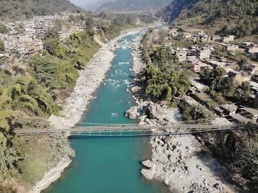
Every Manaslu Circuit and Tsum Valley adventure begins with one long, unforgettable day on the road. The drive from Kathmandu to Machha Khola covers about 150–160 km and usually takes 7–9 hours by jeep, moving from the busy Prithvi Highway to quiet river valleys and, finally, a rough mountain track beside the Budhi Gandaki River.
Machha Khola (930 m), whose name means "Fish River," is the first overnight stop on both the Manaslu Circuit Trek and the Tsum Valley Trek. Knowing what the road is like helps you choose the right vehicle, pack sensibly and arrive ready to walk the next morning.
This guide covers the exact route, distance and travel time, road conditions by section and season, bus and jeep options with typical costs, and practical tips for a comfortable journey.
The Kathmandu to Machha Khola distance is roughly 150–160 km by road. Travel time is 7–9 hours by private jeep and often 10–12 hours by local bus, depending on traffic, road works and weather.
|
Detail |
Information |
|---|---|
|
Road distance |
About 150–160 km |
|
Travel time by private jeep |
7–9 hours |
|
Travel time by local bus |
About 10–12 hours, often with a change of vehicle |
|
Main route |
Kathmandu – Malekhu – Dhading Besi – Arughat – Soti Khola – Machha Khola |
|
Kathmandu altitude |
1,400 m |
|
Machha Khola altitude |
930 m |
|
District |
Gorkha, Gandaki Province |
|
Road surface |
Paved to Dhading Besi, then increasingly rough; unpaved beyond Arughat |
|
Best months to travel |
October–November and March–May |
|
Used by |
Manaslu Circuit Trek (Day 3) and Tsum Valley Trek (Day 3) |
Online map apps sometimes show shorter times. Real journeys take longer because of narrow roads, rough sections and stops.
Most jeeps and trekking vehicles take the Dhading Besi route, which is the most direct way to Arughat and the Budhi Gandaki valley.
Some local buses run Kathmandu – Mugling – Gorkha Bazaar – Arughat instead, staying on the Prithvi Highway for longer before turning north. It can be useful when the Dhading road is blocked, but it is usually slower for trekkers heading straight to Machha Khola.
The road starts smooth and gets rougher the closer you get to the mountains. The first half is paved highway; the last stretch after Arughat is a narrow, unpaved mountain track.
|
Section |
Surface |
What to expect |
|---|---|---|
|
Kathmandu – Malekhu |
Paved highway |
Heavy traffic, trucks, possible road-widening delays |
|
Malekhu – Dhading Besi |
Mostly paved |
Winding hill road, generally smooth |
|
Dhading Besi – Arughat |
Mixed paved and rough |
Narrower road, bumpy patches, slower driving |
|
Arughat – Soti Khola |
Rough, partly unpaved |
Dust in the dry season, mud and potholes after rain |
|
Soti Khola – Machha Khola |
Unpaved dirt track |
Narrow, cliffside sections, landslide-prone, 4WD recommended |
The road was extended from Soti Khola to Machha Khola only in recent years, and the upper track is still being improved. In the dry season, jeeps can sometimes continue beyond Machha Khola toward Jagat, but standard Manaslu and Tsum itineraries start walking from Machha Khola. Conditions change from year to year, so Nepal Trip Services checks the latest road status before each departure.
There are no flights or trains to Machha Khola, so every trekker arrives by road. You have three main choices.
|
Option |
Approx. cost |
Travel time |
Comfort |
Best for |
|---|---|---|---|---|
|
Private 4WD jeep |
From about USD 175 per vehicle (up to 6 people) |
7–9 hours |
Highest; stop when you like |
Groups, families, anyone short on time |
|
Shared jeep |
About USD 20–35 per person |
8–10 hours |
Moderate; fixed schedule, full vehicle |
Solo travelers and couples on a budget |
|
Local bus |
About USD 8–20 per person |
10–12 hours, often with a change |
Basic; crowded, frequent stops |
Budget travelers with flexible time |
Prices are approximate and change with fuel costs, season and demand. Confirm current fares before you travel.
A private 4WD jeep is the fastest, safest and most comfortable way to reach Machha Khola. It picks you up at your hotel, handles the rough upper track well and lets you stop for photos and meals. With a group of four to six, the cost per person is close to a shared jeep.
Shared jeeps usually leave early in the morning from Kathmandu's western bus parks and fill up with locals and trekkers. They are a good middle option, but departure times can shift and seats are tight. You may need to change vehicles at Arughat or Soti Khola.
Local buses are the cheapest choice. Most run to Arughat or Soti Khola, and direct buses to Machha Khola are limited, so expect to switch to a jeep or bus for the last stretch. Buses are slow, crowded and stop often, but they give you a real view of rural Nepal.
If you book the Tsum Valley Trek or the Manaslu Circuit Trek, ground transport from Kathmandu to Machha Khola and the return to Kathmandu are included. Our team arranges reliable jeeps where the road requires them, so you don't need to sort out tickets or vehicle changes yourself.
A little preparation makes this long day far more comfortable.
Machha Khola is a small riverside village of teahouses and farms on the Budhi Gandaki. You will spend your first night in the mountains here, and the next morning you start walking toward Jagat, where your permits are checked at the entrance to the Manaslu Conservation Area.
The 15-day Manaslu Circuit Trek circles the world's eighth-highest mountain, Manaslu (8,163 m). From Machha Khola, the trail climbs through Jagat, Deng, Namrung, Lho and Samagaun, then crosses Larkya La Pass (5,160 m) before descending to Dharapani. It is rated moderate to challenging and suits trekkers with some high-altitude experience.
The 13-day Tsum Valley Trek follows the same trail as far as Ekle Bhatti, then turns north into the sacred, restricted Tsum Valley. Highlights include Milarepa's Cave (Piren Phu), Mu Gompa (3,700 m) and Rachen Gompa. It is rated moderate, with no high pass.
|
|
Manaslu Circuit Trek |
Tsum Valley Trek |
|---|---|---|
|
Duration |
15 days |
13 days |
|
Drive from Kathmandu |
Day 3, to Machha Khola |
Day 3, to Machha Khola |
|
Max altitude |
5,160 m (Larkya La Pass) |
3,700 m (Mu Gompa) |
|
Difficulty |
Moderate to challenging |
Moderate |
|
Permits |
Manaslu RAP, MCAP, ACAP |
Tsum Valley RAP, MCAP |
|
Ends at |
Dharapani, then drive to Kathmandu |
Tatopani/Jagat, then drive to Kathmandu |
Want both? The two treks combine well: explore Tsum first, then continue onto the Manaslu Circuit. Browse all our Manaslu region treks.
How you get back depends on which trek you choose.
In both cases, you arrive in Kathmandu in the evening, ready for a hot shower and a celebration dinner. Keep a buffer day before your international flight in case of road delays.
Machha Khola is about 150–160 km from Kathmandu by road. The usual route runs along the Prithvi Highway to Malekhu, then north through Dhading Besi, Arughat and Soti Khola. Straight-line distances on maps look shorter, but the winding mountain road adds many kilometers.
A private jeep usually takes 7–9 hours. Shared jeeps take around 8–10 hours, and local buses often take 10–12 hours, especially if you change vehicles. Traffic, road works and landslides after rain can add more time, so plan for a full day.
The road is paved and fairly smooth as far as Dhading Besi. After that, it becomes narrower and bumpier, and beyond Arughat it turns into an unpaved mountain track. The final stretch from Soti Khola to Machha Khola is rough, narrow and landslide-prone, so a 4WD jeep is the best choice.
Direct buses are limited. Most local buses go to Arughat or Soti Khola, where you switch to a jeep or another bus for the last section. If you want a single, direct journey, a private or shared jeep is the more reliable option.
A private 4WD jeep costs from about USD 175 per vehicle for up to six people. Shared jeep seats cost roughly USD 20–35 per person, and local buses about USD 8–20 per person. Prices change with fuel costs, season and demand, so confirm before you book.
Choose a private jeep if you are traveling in a group, want hotel pickup or value comfort and flexible stops. A shared jeep suits solo travelers and couples on a budget who don't mind a fixed schedule and tight seating. For groups of four or more, a private jeep often costs about the same per person.
Public buses and shared jeeps usually depart early in the morning from bus parks in the north-west of Kathmandu, such as the Machhapokhari and Gongabu area. Departure points and times change, so check locally the day before. Private jeeps pick you up from your hotel.
The road is used daily by locals and trekkers and is generally safe with an experienced driver. The risks come from narrow cliffside sections and landslides, especially in the monsoon. Traveling in the dry season, in daylight and with a well-maintained 4WD jeep greatly reduces the risk.
In the dry season, jeeps sometimes continue toward Jagat, but conditions vary and the track can close after rain. Standard Manaslu Circuit and Tsum Valley itineraries begin walking at Machha Khola, which also helps your body adjust gradually to the trail.
Machha Khola sits at about 930 m, lower than Kathmandu (1,400 m). There is no risk of altitude sickness on the drive itself. The first real altitude gain begins on the trek, as you climb gradually toward Jagat (1,340 m) and beyond.
October and November are the best months, with dry roads and clear skies. March to May is also good, though dusty. The monsoon months (June–August) bring the highest risk of landslides and road blockages, and winter is dry but cold in the early morning.
Yes. Malekhu, Dhading Besi and Arughat have roadside restaurants serving dal bhat, noodles, tea and snacks. Arughat and Soti Khola are common lunch stops. Beyond Soti Khola, options are limited, so carry water and snacks for the final stretch.
You don't need a special permit just to drive there, but the treks beyond require restricted-area and conservation permits. These are checked at Jagat and other checkpoints. Carry your passport and permits with you, and let your agency arrange them before you leave Kathmandu.
Yes. Machha Khola is the first overnight stop and the walking start point for both the Manaslu Circuit Trek and the Tsum Valley Trek with Nepal Trip Services. The two routes share the trail up the Budhi Gandaki until Ekle Bhatti, where the Tsum trail turns north.
Drivers usually wait for the road to be cleared, or passengers walk across the blocked section and continue in another vehicle on the far side. In serious cases, the night may be spent at Arughat or Soti Khola. Your guide will adjust the plan, which is why a spare day in your schedule is wise.
The drive from Kathmandu to Machha Khola is long and bumpy, but it is also your first look at rural Nepal: river gorges, rice terraces, small bazaars and the first glimpse of the Budhi Gandaki. With an early start, the right vehicle and a little patience, it becomes part of the adventure rather than a chore.
When you trek with Nepal Trip Services, this whole journey is taken care of. Transport, permits, a licensed guide and teahouse stays are all arranged, so you can simply sit back and enjoy the road.
Ready to go? Explore the Manaslu Circuit Trek and the Tsum Valley Trek, build your own route with our trip planner, or contact us for current road conditions and departure dates.
Discover more articles that match your interests! Explore these similar blogs packed with insights, tips, and stories to keep you inspired.
How hard is the Tsum Valley trek? Altitude (3,700 m), daily hours, trail conditions, hardest days, permits and training ...
Stay safe on the Tsum Valley trek. Learn the altitude profile to Mu Gompa (3,700 m), early signs of AMS, and proven accl...
Plan your Tsum Valley trek with our 13-day itinerary: daily routes, altitudes, walking hours and highlights from Machha ...
Discover Mu Gompa, Tsum Valley\'s highest monastery at 3,700 m: its history, what to see, how to get there, where to sta...
Visit Rachen Gompa, the Tsum Valley nunnery founded in 1905. Learn its history, the nuns\' daily life, how to get there ...
Explore Milarepa’s caves in Nepal, from Piren Phu on the Tsum Valley Trek to Manang, Lapchi and Yolmo. Legends, routes...