Jomsom, Nepal: Complete Travel & Trekking Guide.
By Nepal Trip Services On 25 Sep 2026
By Nepal Trip Services On 25 Sep 2026
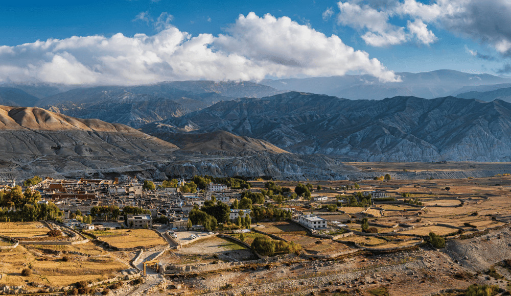
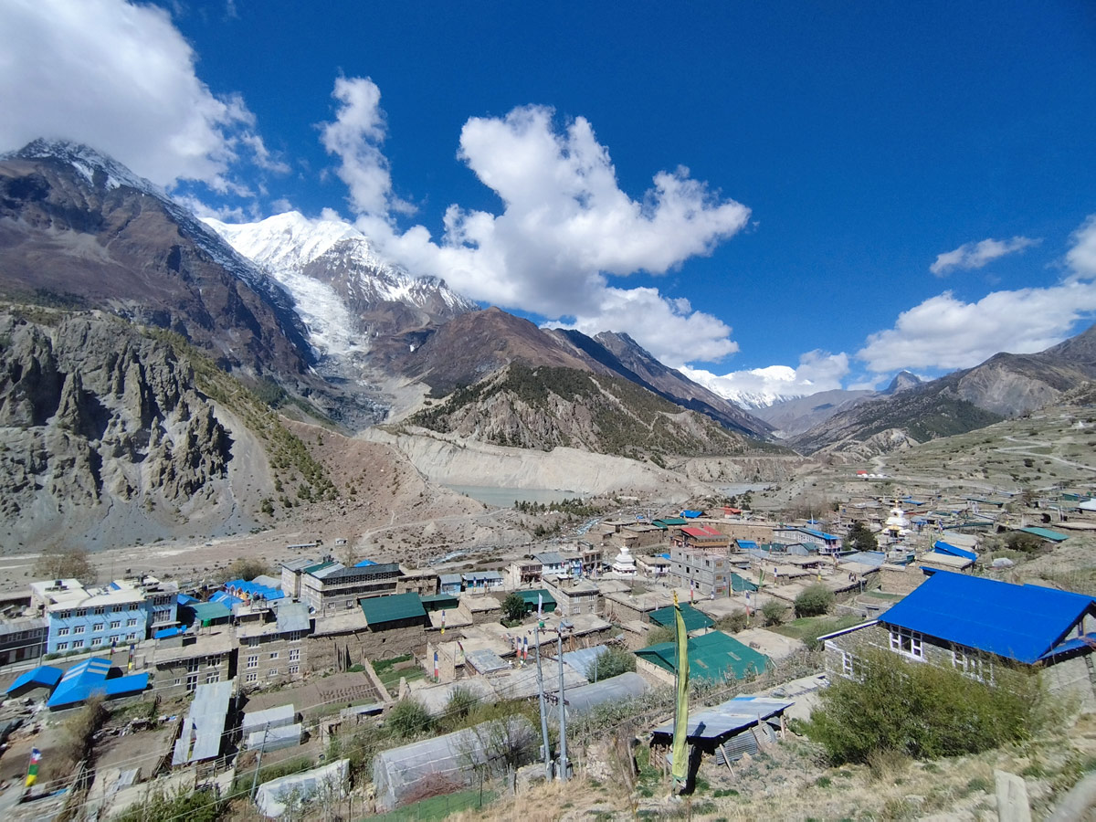
Serving as the administrative heart of the Mustang District, Jomsom is one of the most important gateway towns in the entire Nepalese Himalayas. Straddling the banks of the Kali Gandaki River and framed by the towering peaks of Dhaulagiri and Nilgiri, this bustling high-altitude town connects trekkers, pilgrims, and travelers to some of the most remarkable destinations in the region, including Upper Mustang and the sacred site of Muktinath. For anyone completing the Annapurna Circuit Trek, Jomsom marks a pivotal stop where the trail's high-altitude challenges give way to relative comfort and modern conveniences. This complete guide covers everything you need to know about visiting Jomsom.
Jomsom sits at an elevation of approximately 2,743 meters (8,999 feet) in the Mustang District of Gandaki Province, Nepal. Also known historically as Dzongsam, meaning "New Fort," the town serves as the district headquarters and lies directly along the banks of the Kali Gandaki River, with the soaring peaks of Dhaulagiri and Nilgiri forming a dramatic backdrop on either side.
| Feature | Details |
|---|---|
| Elevation | 2,743 meters (8,999 feet) |
| Location | Mustang District, Gandaki Province, Nepal |
| Former Name | Dzongsam ("New Fort") |
| Administrative Role | District headquarters of Mustang |
| Primary Ethnic Group | Thakali people |
| Nearby River | Kali Gandaki River |
| Airport | Jomsom Airport (JMO), elevation 2,736 meters |
| Gateway To | Upper Mustang, Kagbeni, Muktinath, Lo Manthang |
Jomsom plays a central role for travelers throughout the Mustang and Annapurna regions for several key reasons:
Historically, Jomsom played a vital role in the ancient Tibet-India salt trade that once defined the economy of the entire Kali Gandaki valley. Caravans moved through the town for centuries, carrying goods between Tibet and the lowlands of Nepal and India, establishing Jomsom as an important waypoint along this historic route.
Since the early 1970s, Jomsom has served as the official district headquarters of Mustang, housing various government offices and a company of the Nepalese Army. Today, the town's economy has diversified considerably, now driven by a combination of agriculture, livestock, tourism, and remittances from Thakali community members working abroad.
Jomsom Airport is one of the most well-known domestic airports in Nepal, both for its scenic approach and its reputation as a challenging airfield for pilots.
| Feature | Details |
|---|---|
| IATA Code | JMO |
| ICAO Code | VNJS |
| Elevation | 2,736 meters (8,976 feet) |
| Runway | 739m asphalt runway (Direction 06/24) |
| Flight Route | Pokhara to Jomsom, approximately 20 minutes |
| Operating Hours | Morning flights only, due to strong afternoon winds |
Because heat from the sun causes strong southerly winds to funnel through the Kali Gandaki Gorge later in the day, flights to and from Jomsom typically operate only during the early morning hours, when conditions remain calmer and safer for aircraft.
There are several ways to reach Jomsom, depending on your starting point and preferred travel style:
Jomsom offers a range of activities suited to both trekkers passing through and travelers spending additional time in the area:
| Destination | Distance/Travel Time | Highlights |
|---|---|---|
| Marpha | 20–30 minutes by vehicle, ~2 hours on foot | Apple orchards, whitewashed architecture, Thakali culture |
| Kagbeni | 20–30 minutes by vehicle | Medieval architecture, ancient monastery, gateway to Upper Mustang |
| Muktinath | 1–2 hours by vehicle or trek | Sacred Hindu-Buddhist pilgrimage site |
| Upper Mustang / Lo Manthang | Multi-day trek, restricted permit required | Ancient walled city, Tibetan Buddhist heritage |
| Season | Months | Conditions |
|---|---|---|
| Spring | March – May | Mild temperatures, good trekking conditions |
| Autumn | September – November | Clearest skies, most popular season |
| Winter | December – February | Cold, occasional flight delays due to weather |
| Monsoon | June – August | Drier than much of Nepal due to rain shadow, though winds remain strong |
Regardless of season, flights and outdoor activities are generally best scheduled for the morning hours, before the valley's characteristic afternoon winds intensify.
Travelers passing through Jomsom as part of a broader Mustang or Annapurna itinerary typically need the following permits:
| Factor | Jomsom | Marpha | Kagbeni |
|---|---|---|---|
| Role | Administrative and transport hub | Quiet agricultural village | Historic gateway village |
| Population | ~1,370 | Smaller, close-knit community | Smaller, traditional community |
| Known For | Airport, government offices, shops | Apple orchards, clean streets | Medieval architecture, ancient monastery |
| Atmosphere | Busy, functional | Charming, relaxed | Rustic, historic |
Jomsom sits at an elevation of approximately 2,743 meters (8,999 feet) in the Mustang District of Gandaki Province, Nepal. It lies directly along the banks of the Kali Gandaki River, with the towering peaks of Dhaulagiri and Nilgiri forming a dramatic backdrop on either side of the town.
Jomsom is also historically known as Dzongsam, which translates to "New Fort" in the local dialect. This name reflects the town's origins as a fortified settlement that later developed into the administrative center it is today.
Jomsom serves multiple essential functions for the region, making it a key waypoint for nearly every visitor to Mustang:
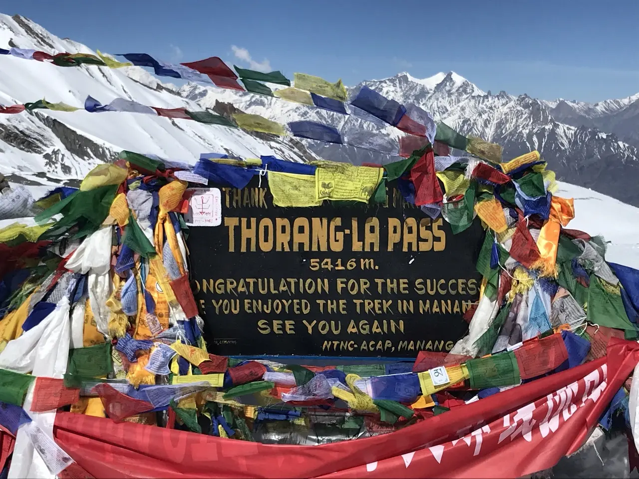
Jomsom can be reached by a short scenic flight from Pokhara, by road via jeep or bus, or on foot as part of the Annapurna Circuit Trek after crossing Thorong La Pass and descending through Muktinath. Each option offers a different experience, from dramatic aerial mountain views to the satisfaction of arriving on foot after a demanding trek.
Yes, Jomsom marks a pivotal stop on the Annapurna Circuit Trek, typically reached after trekkers cross Thorong La Pass from Manang and descend through Muktinath. It represents a transition point where the trail's high-altitude challenges give way to relatively more comfort and modern conveniences.
Jomsom Airport is a small domestic airport known both for its scenic mountain approach and its reputation as a challenging airfield due to strong winds and high surrounding terrain. Flights typically operate only during the morning hours, before afternoon winds intensify through the Kali Gandaki Gorge.
Heat from the sun causes strong southerly winds to funnel through the narrow Kali Gandaki Gorge later in the day, making afternoon flying conditions unsafe for aircraft. As a result, all scheduled flights between Pokhara and Jomsom are typically completed before midday.
Popular activities in Jomsom include exploring the town's stone streets and shops, visiting the Mustang Eco Museum to learn about local history and culture, and searching for sacred shaligram fossils along the banks of the Kali Gandaki River. The town also offers stunning views of Dhaulagiri and Nilgiri directly from its center.
| Destination | Travel Time | Highlights |
|---|---|---|
| Marpha | 20–30 min by vehicle | Apple orchards, whitewashed houses |
| Kagbeni | 20–30 min by vehicle | Medieval architecture, ancient monastery |
| Muktinath | 1–2 hours | Sacred pilgrimage site |
Travelers need an Annapurna Conservation Area Permit (ACAP) and a Trekkers' Information Management System (TIMS) card for the general Mustang region. Those continuing on to Upper Mustang and Lo Manthang require an additional Restricted Area Permit.
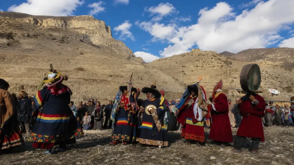
Jomsom is home to a predominantly Thakali population, an ethnic group historically known for their role in the trans-Himalayan salt trade between Tibet and Nepal. Their cultural influence is visible throughout the town's architecture, cuisine, and daily customs.
Shaligram fossils are ammonite stones found along the banks of the Kali Gandaki River, considered sacred by Hindus as a symbol of Lord Vishnu. These fossils are believed to be found only in this specific river, making them a unique and spiritually significant discovery for visitors exploring the riverbed.
Spring (March to May) and autumn (September to November) offer the clearest skies and most stable weather for both trekking and flying. Winter can bring cold temperatures and occasional flight delays, while monsoon season remains relatively dry due to the region's rain shadow, though strong winds persist year-round.
Yes, Jomsom functions as the primary gateway and return point for travelers heading into the restricted region of Upper Mustang and the ancient walled city of Lo Manthang. A special Restricted Area Permit is required in addition to standard Mustang region permits for this extended journey.
Jomsom offers a unique blend of administrative significance, cultural depth, and access to some of Mustang's most remarkable nearby destinations, making it worth more than a brief stopover. Whether you're exploring its local museum, searching for sacred fossils, or using it as a base for excursions to Marpha, Kagbeni, or Muktinath, Jomsom adds meaningful value to any journey through the Annapurna Circuit Trek.
Jomsom stands as one of the most functionally important towns in the entire Mustang region, connecting trekkers, pilgrims, and travelers to some of Nepal's most remarkable high-altitude destinations. Whether you're arriving by a scenic short flight from Pokhara, descending from the demanding crossing of Thorong La Pass, or preparing to venture further into the restricted kingdom of Upper Mustang, Jomsom offers a practical and culturally rich waypoint along the journey. For travelers exploring this extraordinary corner of the Himalayas, Jomsom remains an essential stop within the broader adventure of the Annapurna Circuit Trek.
Discover more articles that match your interests! Explore these similar blogs packed with insights, tips, and stories to keep you inspired.
Everything on Thorong La Pass — altitude, difficulty, weather, route & crossing times. Complete guide for the Annapurn...
Complete guide on how to prepare for the Annapurna Circuit Trek — training, gear, permits, insurance & mental readines...
Discover Besisahar, Nepal — the official gateway to the Annapurna Circuit Trek. Complete guide to altitude, history & ...
Discover the Marsyangdi River — the Annapurna Circuit\'s raging river. Complete guide to its geography, origins & trek...
Discover Manang, Nepal — Annapurna Circuit\\'s key acclimatization village with monasteries, glacial lakes & Thorong L...
Explore Manangi culture in Nepal — Tibetan Buddhist heritage, trans-Himalayan trading history & unique lifestyle of th...