Marsyangdi River, Nepal: Complete Travel & Trekking Guide
By Nepal Trip Services On 24 Sep 2026

By Nepal Trip Services On 24 Sep 2026
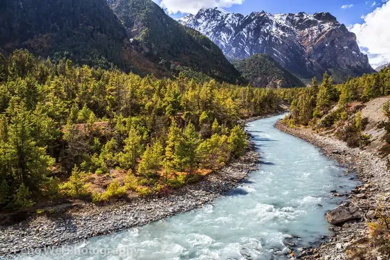
Known as the "Raging River," the Marsyangdi carves its way through the heart of the Annapurna Circuit Trek, accompanying trekkers for much of the route's early and middle stages. Born from glacial meltwater high in the Annapurna, Manaslu, and Larkya ranges, this powerful river winds nearly 150 kilometers through steep gorges and terraced farmland before eventually joining the Trishuli, its swift currents and dramatic mountain backdrop making it one of the most memorable natural features of the entire trek. This complete guide covers everything you need to know about this powerful Himalayan river, from its geography and origins to what trekkers can expect along the trail, helping you appreciate the landscape unfolding beside you during those early, riverside days of the journey.
The Marsyangdi (also spelled Marshyangdi) is a mountain river in central Nepal, originating northwest of the Annapurna massif near Manang village and flowing approximately 150 kilometers through the districts of Manang, Lamjung, Gorkha, and Tanahu before joining the Trishuli River near Mugling.
| Detail | Information |
|---|---|
| Length | ~150 km/93 miles |
| Meaning of Name | "Raging one" |
| Origin Altitude | ~3,600m, near Manang village |
| River System | Narayani River (via Trishuli, then Gandaki, then Ganges) |
| Districts Crossed | Manang, Lamjung, Gorkha, Tanahu |
| Confluence Point | Joins the Trishuli River near Mugling |
The Marsyangdi begins at the confluence of two mountain rivers — the Khangsar Khola and the Jharsang Khola — northwest of the Annapurna massif at an altitude of roughly 3,600 meters near Manang village. Its waters are fed primarily by glaciers from three major mountain ranges:
Glacial meltwater from the Gangapurna Glacier in Manang district provides a particularly significant contribution to the river's flow, supplemented by perennial and seasonal mountain springs.
The beginning of the Annapurna Circuit trekking route follows the Marsyangdi river valley directly, with trekkers walking alongside its powerful currents from Besisahar through villages like Bahundanda, Jagat, and Dharapani before the trail climbs away from the riverbank toward Manang.
Notably, half of both the Annapurna Circuit trail and the Manaslu Circuit trail follow this same river system, giving trekkers on either route stunning, uninterrupted views of the water carving through deep Himalayan gorges.
As the Marsyangdi flows through its rugged valley, it offers spectacular views of towering peaks including Annapurna II, Annapurna III, and Gangapurna, framing the river with some of Nepal's most iconic Himalayan scenery.
True to its name — Marsyangdi translates to "raging one" — this river is known for its fast-paced, powerful currents that cut through deep gorges and cascade down dramatic waterfalls throughout its course.
The river has historically been one of Nepal's premier destinations for white water rafting and kayaking, offering:
A note on current conditions: Due to the construction of several hydropower projects along the river's main stem — including the Upper Marsyangdi A, Middle Marsyangdi, and Marsyangdi Hydropower stations — the once-famous multi-day rafting trips have become significantly less available than in past decades, as sections of the riverbed now run dry downstream of dam infrastructure.
| Tributary | Side |
|---|---|
| Khangsar Khola | Source confluence |
| Jharsang Khola | Source confluence |
| Nagdi Khola | Left |
| Dordi Khola | Left |
| Chepe Khola | Left |
| Daraundi River | Left |
| Paudi Khola | Right |
| Chundi Khola | Right |
The Marsyangdi begins at the confluence of two mountain rivers — the Khangsar Khola and the Jharsang Khola — northwest of the Annapurna massif at an altitude of roughly 3,600 meters near Manang village.
The Marsyangdi River is approximately 150 kilometers (93 miles) long, flowing through the districts of Manang, Lamjung, Gorkha, and Tanahu before joining the Trishuli River near Mugling.
Marsyangdi translates to "raging one," a fitting name given the river's powerful, fast-flowing currents that cut through deep Himalayan gorges throughout its course.
The river is fed primarily by glaciers from the Annapurna Himalayan range, the Manaslu Himalayan range, and the Larkya Himalayan sub-range, supplemented by perennial and seasonal mountain springs.
The beginning of the Annapurna Circuit trekking route follows the Marsyangdi river valley directly, with trekkers walking alongside its currents from Besisahar through Bahundanda, Jagat, and Dharapani before the trail climbs toward Manang.
Yes, half of both the Annapurna Circuit trail and the Manaslu Circuit trail follow this same river system, giving trekkers on either route scenic, uninterrupted views of the water carving through the valley.
Trekkers along the river enjoy views of towering peaks including Annapurna II, Annapurna III, and Gangapurna, framing the river with some of Nepal's most iconic Himalayan scenery.
Historically, yes — the Marsyangdi was one of Nepal's premier rafting and kayaking rivers, though several hydropower projects along its main stem have significantly reduced availability of the once-famous multi-day rafting trips in recent years.
Snow trout is a notable fish species found in the Marsyangdi and its tributaries, including the Nyagdi and Dordi rivers.
Major tributaries include the Khangsar Khola, Jharsang Khola, Nagdi Khola, Dordi Khola, Chepe Khola, Daraundi River, Paudi Khola, and Chundi Khola.
The Marsyangdi joins the Trishuli River near Mugling, which is part of the broader Narayani River system, ultimately flowing into the Gandaki and then the Ganges in India.
Yes, several hydropower stations operate along the river's main stem, including the Upper Marsyangdi A, Middle Marsyangdi, and Marsyangdi Hydropower stations, which have altered sections of the river's natural flow.
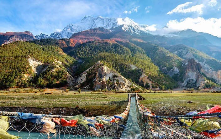
The trail sections from Besisahar to Bahundanda, Bahundanda to Jagat, and Jagat to Dharapani follow the Marsyangdi river valley most directly, including numerous suspension bridge crossings.
Some itineraries can be customized to combine a Marsyangdi rafting trip with an Annapurna Conservation Area trek, though availability of full multi-day rafting sections has decreased due to hydropower infrastructure.
Understanding the Marsyangdi's origins and geography adds genuine depth to the trekking experience, connecting travelers to the glacial and mountain systems that shape the landscape throughout the early stages of the Annapurna Circuit Trek.
The Marsyangdi River is more than just scenery along the Annapurna Circuit Trek. Its glacier-fed waters shape the landscape from Besisahar through the lower valleys toward the mountain villages of Manang. Understanding the river’s origins, surrounding landscapes, and role in the region adds greater depth to the Annapurna Circuit Trek experience.
Ready to experience the Marsyangdi River and the spectacular landscapes of the Annapurna region? Explore the complete Annapurna Circuit Trek itinerary with Nepal Trip Services and discover this remarkable Himalayan journey for yourself.
Discover more articles that match your interests! Explore these similar blogs packed with insights, tips, and stories to keep you inspired.
Everything on Thorong La Pass — altitude, difficulty, weather, route & crossing times. Complete guide for the Annapurn...
Complete guide on how to prepare for the Annapurna Circuit Trek — training, gear, permits, insurance & mental readines...
Discover Besisahar, Nepal — the official gateway to the Annapurna Circuit Trek. Complete guide to altitude, history & ...
Discover Manang, Nepal — Annapurna Circuit\\'s key acclimatization village with monasteries, glacial lakes & Thorong L...
Explore Manangi culture in Nepal — Tibetan Buddhist heritage, trans-Himalayan trading history & unique lifestyle of th...
Discover Muktinath, Nepal\'s sacred Hindu-Buddhist pilgrimage site — temple history, Thorong La Pass access & travel t...