Manang, Nepal: Complete Travel & Trekking Guide
By Nepal Trip Services On 24 Sep 2026

By Nepal Trip Services On 24 Sep 2026
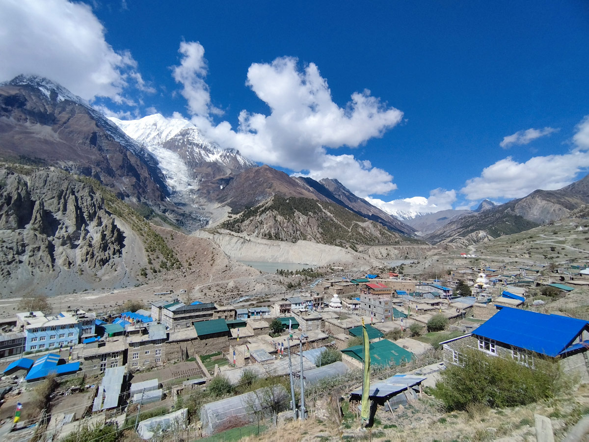
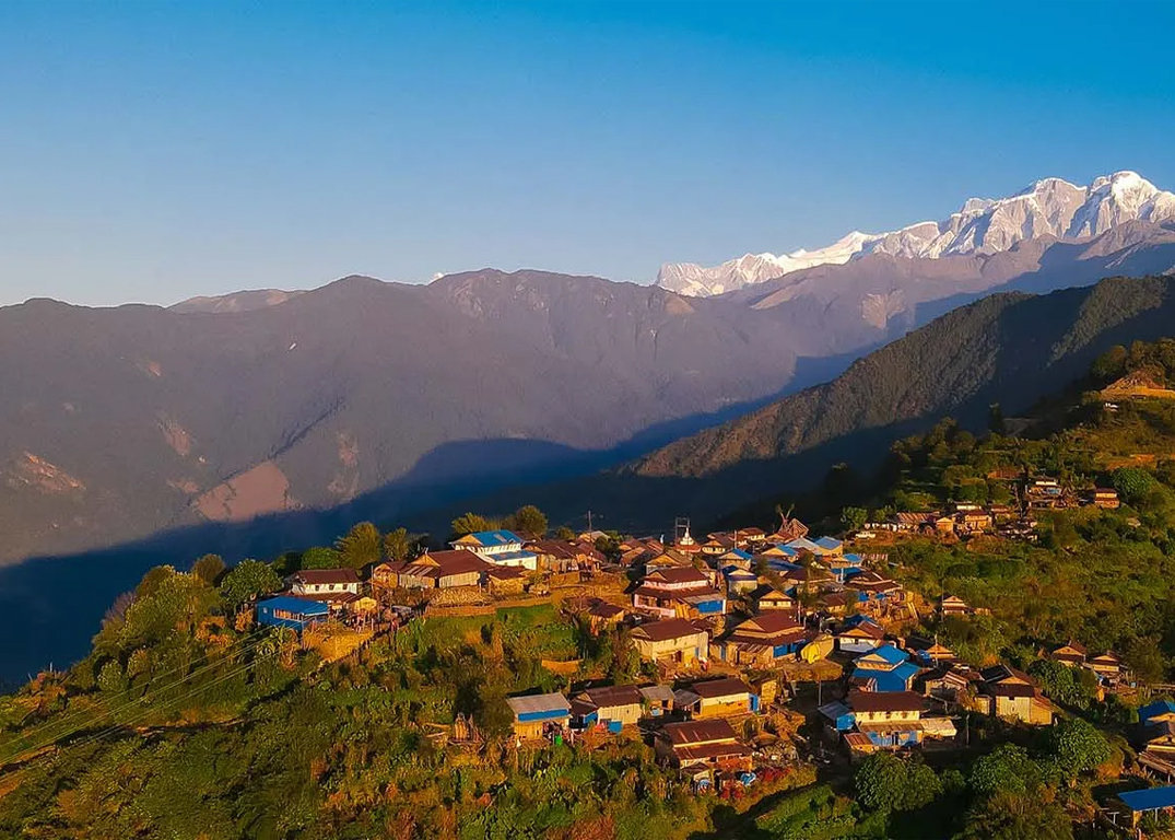
Tucked away in a high, arid valley on the northern side of the Annapurna massif, Manang is one of the most fascinating villages you'll encounter in the Nepalese Himalayas. With its stark Tibetan-influenced landscape, ancient monasteries, and dramatic mountain backdrops, Manang feels worlds apart from the lush, green lowlands most trekkers pass through earlier in their journey. It's also a critical acclimatization stop for anyone attempting to cross the famous Thorong La Pass. This complete guide covers everything you need to know about Manang — its geography, culture, trekking logistics, and practical travel tips.
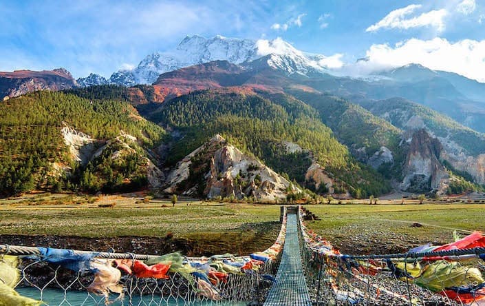
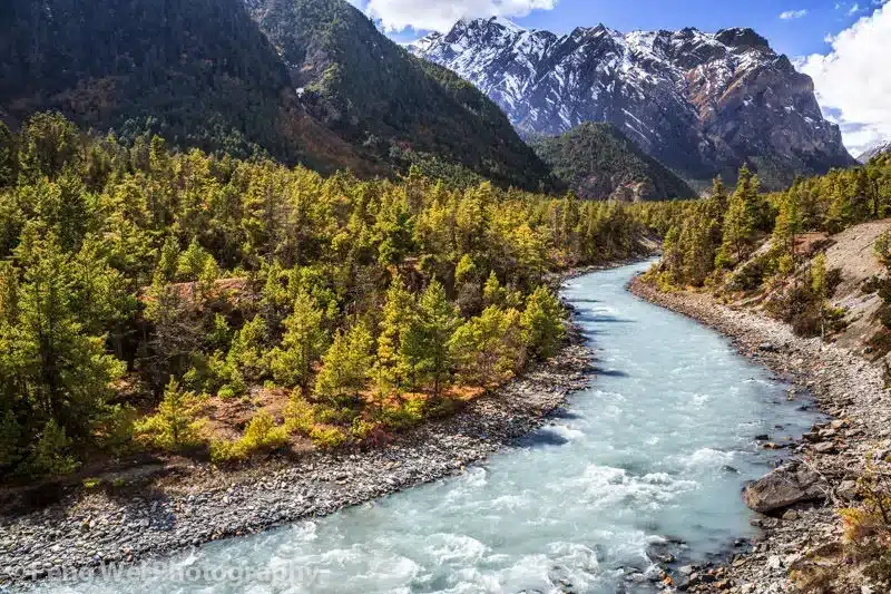
Manang is a village and district headquarters situated in the Manang District of Gandaki Province, in north-central Nepal. It sits at an elevation of approximately 3,519 meters (11,545 feet), nestled in the Manang Valley along the Marsyangdi River, in the rain shadow of the Annapurna range. Because it lies north of the main Himalayan divide, Manang has a notably drier, more Tibetan-like climate and landscape compared to the subtropical villages found on the southern side of the Annapurna Circuit.
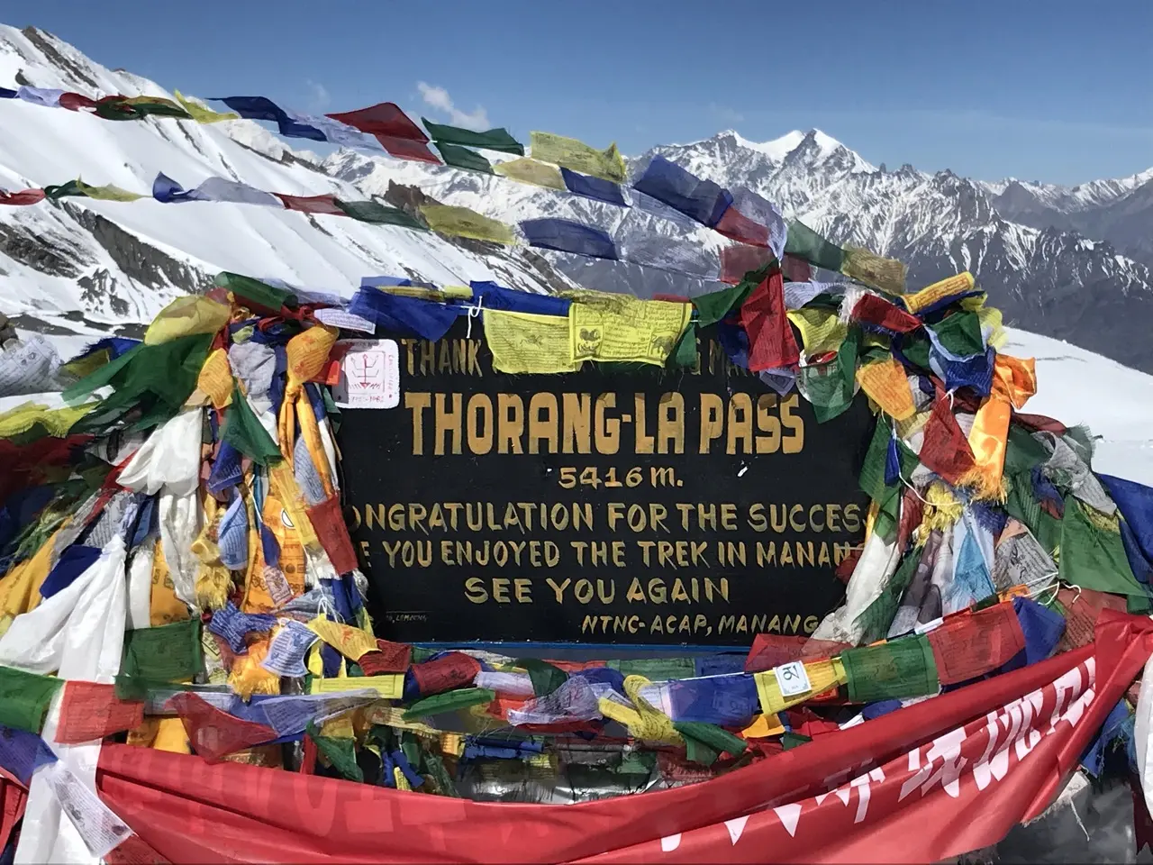
Manang is one of the most important stops along the Annapurna Circuit Trek, serving as a key acclimatization point before trekkers ascend toward Thorong La Pass, one of the highest trekking passes in the world.
| Feature | Details |
|---|---|
| Elevation | 3,519 meters (11,545 feet) |
| Location | Manang District, Gandaki Province, Nepal |
| Region | Annapurna region, north of the Annapurna massif |
| Population | Small permanent population; swells seasonally with trekkers |
| Primary Trek | Annapurna Circuit Trek |
| Nearby Peaks | Annapurna II, Annapurna III, Gangapurna, Tilicho Peak |
| Climate Type | Semi-arid, Tibetan-influenced (rain shadow zone) |
| Best Season | Pre-monsoon (March–May) and post-monsoon (Sept–Nov) |
| Known For | Acclimatization stop, monasteries, Himalayan Rescue Association post |
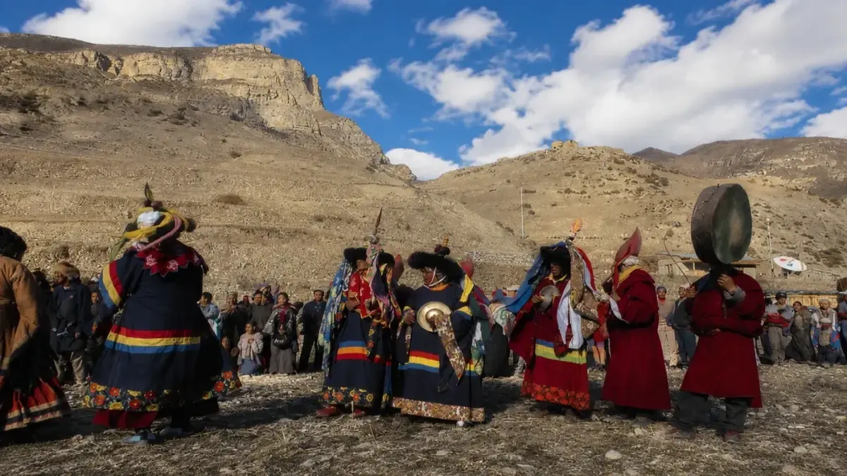
Manang has long served as a crossroads between Tibet and the lowlands of Nepal, and its culture reflects centuries of trade, migration, and Tibetan Buddhist influence. The people of Manang, known as Manangis, historically built their economy around trans-Himalayan trade routes, moving goods between Tibet and India long before modern tourism arrived.
This trading heritage gave Manangis unique trade privileges under Nepali law decades ago, which some families used to build businesses that extended well beyond the valley itself. Today, while trade routes have changed, the architecture, monasteries, and daily customs in Manang still carry strong Tibetan Buddhist characteristics, visible in prayer wheels, chortens (stupas), and monastery murals throughout the village.
Manang isn't just a scenic stopover — it plays a critical functional role in the Annapurna Circuit Trek. Here's why almost every itinerary includes at least one full rest day here:
Manang is reached exclusively on foot (or occasionally by helicopter in emergencies) as part of the broader Annapurna Circuit Trek. There are no roads suitable for regular vehicle access beyond certain lower sections of the trail, though a rough jeep track does exist in parts of the lower valley.
| Day | Route Segment | Approx. Altitude |
|---|---|---|
| Day 1 | Kathmandu/Pokhara to Besisahar, drive to Chame or Koto | 1,430m – 2,675m |
| Day 2 | Chame to Pisang | 3,200m |
| Day 3 | Pisang to Manang (via upper or lower route) | 3,519m |
| Day 4 | Acclimatization day in Manang | 3,519m |
| Day 5 | Manang to Yak Kharka | 4,018m |
| Day 6 | Yak Kharka to Thorong Phedi/High Camp | 4,540m – 4,925m |
| Day 7 | Cross Thorong La Pass to Muktinath | 5,416m → 3,760m |
Most trekkers spend at least one full acclimatization day in Manang before continuing, and many extend this with a side hike to boost altitude adaptation further.
Beyond simply resting, Manang offers plenty of worthwhile activities for trekkers using their acclimatization day productively:
Since altitude adjustment is a top priority, several day hikes are commonly used to gain elevation safely before continuing toward Thorong La Pass:
| Hike | Altitude Gain | Duration (Round Trip) |
|---|---|---|
| Gangapurna Lake viewpoint | Minimal gain | 1–2 hours |
| Praken Gompa | ~200m gain | 2–3 hours |
| Ice Lake (Kicho Tal) | ~900m gain | 6–7 hours |
| Chulu Peak Base Camp direction | ~800m+ gain | Full day |
The "climb high, sleep low" principle is widely practiced here, with Ice Lake being one of the most popular — if strenuous — acclimatization hikes in the entire Annapurna region.
| Season | Months | Conditions |
|---|---|---|
| Spring (Pre-monsoon) | March – May | Mild temperatures, blooming rhododendrons at lower elevations, good visibility |
| Autumn (Post-monsoon) | September – November | Clearest skies, most popular trekking season, stable weather |
| Winter | December – February | Very cold, snow possible at the pass, fewer trekkers |
| Monsoon (Summer) | June – August | Manang stays relatively dry due to rain shadow, but southern trail sections see heavy rain |
Interestingly, because Manang lies in the Annapurna rain shadow, it experiences noticeably less monsoon rainfall than villages on the trek's southern side, making it slightly more visitable in summer than other Himalayan destinations.
| Factor | Manang | Pisang | Muktinath |
|---|---|---|---|
| Altitude | 3,519m | 3,200m | 3,760m |
| Role in Trek | Main acclimatization hub | Early trail village | Post-pass arrival point |
| Facilities | Extensive (shops, health post, bakeries) | Basic | Moderate |
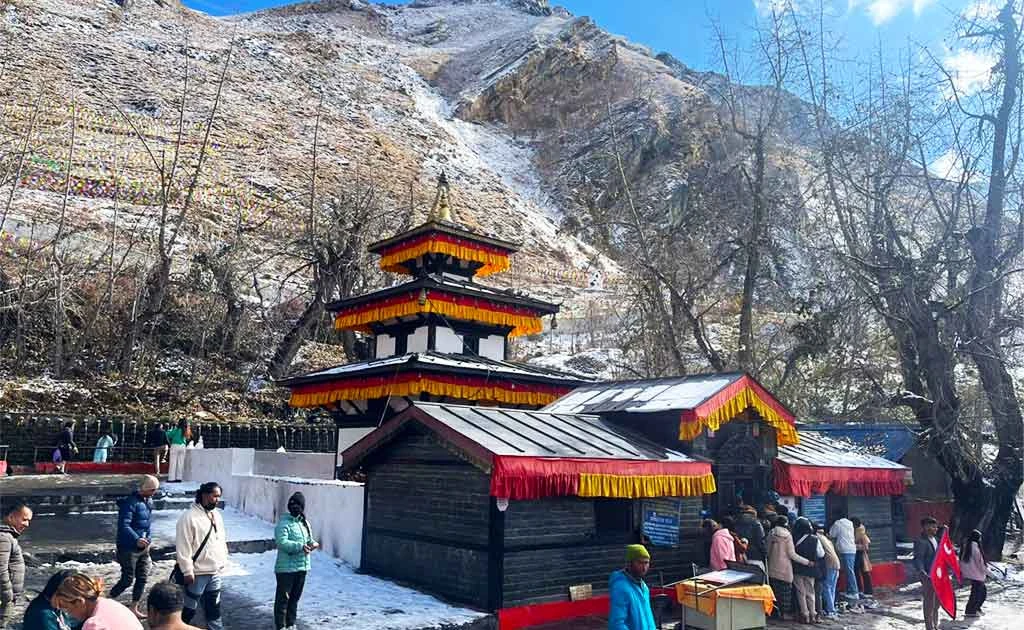
| Cultural Sites | Braga Monastery, Milarepa's Cave | Old Pisang Monastery | Muktinath Temple |
| Typical Stay | 1–2 nights (acclimatization) | 1 night | 1 night |
Since Manang lies within the Annapurna Conservation Area, trekkers need the following permits before arrival:
Both permits can be arranged in Kathmandu or Pokhara before starting the Annapurna Circuit Trek, and checkpoints along the route verify these documents at various stages.
Manang is a village in the Manang District of Gandaki Province, situated in north-central Nepal at an elevation of approximately 3,519 meters (11,545 feet). It lies in the Manang Valley along the Marsyangdi River, on the northern side of the Annapurna massif, within a dry, high-altitude landscape shaped by the mountain range's rain shadow effect.
Manang serves several essential functions for trekkers, which is why nearly every itinerary includes at least one full day here:
Manang is reached only on foot as part of the Annapurna Circuit Trek, typically starting with a drive from Kathmandu or Pokhara to Besisahar, followed by several days of trekking through villages like Chame and Pisang. There are no regular vehicle roads directly into Manang itself, though rough jeep tracks exist in some lower sections of the valley.
| Day | Route Segment | Approx. Altitude |
|---|---|---|
| Day 1 | Kathmandu/Pokhara to Besisahar, drive to Chame/Koto | 1,430m – 2,675m |
| Day 2 | Chame to Pisang | 3,200m |
| Day 3 | Pisang to Manang | 3,519m |
| Day 4 | Acclimatization day in Manang | 3,519m |
Most trekkers spend one to two nights in Manang before continuing toward Yak Kharka and eventually Thorong La Pass.
A rest day in Manang is strongly recommended because it allows the body to adjust to increasing altitude before tackling significantly higher terrain toward Thorong La Pass. Skipping this acclimatization step significantly increases the risk of altitude sickness, which can become severe or life-threatening if trekkers ascend too quickly without proper adjustment time.
Several day hikes are popular for gaining altitude safely before continuing the trek, following the "climb high, sleep low" principle:
Manang offers rich cultural experiences rooted in Tibetan Buddhist heritage, including:
Yes, the Himalayan Rescue Association operates a seasonal health post in Manang, typically staffed during peak trekking seasons (spring and autumn). The post offers daily altitude sickness lectures, basic medical consultations, and emergency guidance, making it an important resource for trekkers heading toward the high-altitude Thorong La Pass.
Since Manang lies within the Annapurna Conservation Area, trekkers must obtain the following before starting their journey:
| Permit | Purpose |
|---|---|
| Annapurna Conservation Area Permit (ACAP) | Required for entry into the conservation area |
| TIMS Card | Trekkers' Information Management System, used for safety tracking |
Both permits are available in Kathmandu or Pokhara and are checked at various checkpoints along the Annapurna Circuit Trek.
The ideal seasons are pre-monsoon spring (March to May) and post-monsoon autumn (September to November), both offering stable weather and clear mountain visibility. Interestingly, because Manang sits in the Annapurna rain shadow, it experiences noticeably less monsoon rainfall than southern trek villages, making it comparatively more visitable in summer months.
| Season | Months | Conditions |
|---|---|---|
| Spring | March – May | Mild temperatures, good visibility |
| Autumn | September – November | Clearest skies, most popular season |
| Winter | December – February | Very cold, possible snow at higher elevations |
| Monsoon | June – August | Drier than other regions due to rain shadow effect |
Essential packing items include:
Manang carries a genuine altitude sickness risk due to its elevation and its position along a route where many trekkers ascend quickly from lower villages. This is precisely why guides and health professionals strongly recommend a mandatory rest day here, along with monitoring for symptoms like headaches, nausea, or dizziness before continuing higher toward Thorong La Pass.
| Factor | Manang | Pisang | Muktinath |
|---|---|---|---|
| Altitude | 3,519m | 3,200m | 3,760m |
| Role in Trek | Main acclimatization hub | Early trail village | Post-pass arrival point |
| Facilities | Extensive (shops, health post, bakeries) | Basic | Moderate |
| Typical Stay | 1–2 nights | 1 night | 1 night |
While Manang serves a critical practical purpose for acclimatization, it also offers genuine cultural and scenic value that many trekkers overlook while focused on reaching Thorong La Pass. Between its ancient monasteries, dramatic views of Annapurna II, III, and Gangapurna, and the turquoise waters of Gangapurna Lake, Manang rewards travelers who take the time to explore it fully rather than treating it as a mere waypoint on the Annapurna Circuit Trek.
Manang stands out as one of the most culturally rich and strategically important stops on the entire Annapurna Circuit. Its dramatic high-altitude scenery, deep Tibetan Buddhist heritage, and essential role in safe acclimatization make it far more than just a rest stop — it's a destination worth savoring in its own right. Whether you're exploring ancient monasteries, hiking to a glacial lake, or simply preparing your body for the challenge of Thorong La Pass, Manang offers an unforgettable chapter in the broader story of the Annapurna Circuit Trek.
Discover more articles that match your interests! Explore these similar blogs packed with insights, tips, and stories to keep you inspired.
Everything on Thorong La Pass — altitude, difficulty, weather, route & crossing times. Complete guide for the Annapurn...
Complete guide on how to prepare for the Annapurna Circuit Trek — training, gear, permits, insurance & mental readines...
Discover Besisahar, Nepal — the official gateway to the Annapurna Circuit Trek. Complete guide to altitude, history & ...
Discover the Marsyangdi River — the Annapurna Circuit\'s raging river. Complete guide to its geography, origins & trek...
Explore Manangi culture in Nepal — Tibetan Buddhist heritage, trans-Himalayan trading history & unique lifestyle of th...
Discover Muktinath, Nepal\'s sacred Hindu-Buddhist pilgrimage site — temple history, Thorong La Pass access & travel t...