Kagbeni, Nepal: Complete Travel & Trekking Guide
By Nepal Trip Services On 25 Sep 2026

By Nepal Trip Services On 25 Sep 2026
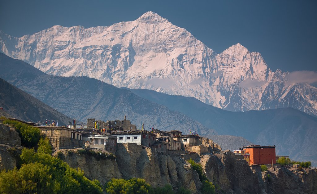
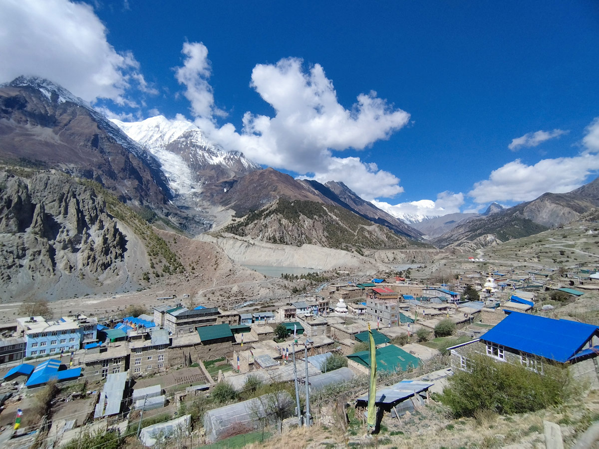
Where the trail to Upper Mustang begins, Kagbeni stands as one of the oldest and most atmospheric villages in the entire Himalayas. With its whitewashed mud-brick houses, narrow medieval alleyways, and centuries-old fortress ruins, this ancient settlement feels like a portal into a Tibetan past that has changed remarkably little over hundreds of years. Sitting at the confluence of two sacred rivers and serving as the official gateway to restricted Upper Mustang, Kagbeni offers travelers on the Annapurna Circuit Trek one of the most culturally rich and visually striking stops along the entire route. This complete guide covers everything you need to know before visiting.
Kagbeni is a village in the Baragung Muktichhetra rural municipality of the Mustang District, situated at an elevation of approximately 2,804 meters (9,199 feet). It lies in the valley of the Kali Gandaki River, at the confluence with the Jhong Khola, the tributary flowing down from Muktinath, placing it directly between two spiritually significant waterways. The village sits roughly 11 kilometers north of Jomsom, along the main trail connecting Lower Mustang to the royal capital of Lo Manthang in Upper Mustang.
| Feature | Details |
|---|---|
| Elevation | 2,804 meters (9,199 feet) |
| Location | Baragung Muktichhetra, Mustang District, Gandaki Province |
| Population | Approximately 555–1,200 residents |
| Rivers | Kali Gandaki River and Jhong Khola (from Muktinath) |
| Historical Significance | One of the oldest villages in the Himalayas |
| Primary Role | Sole gateway to restricted Upper Mustang |
| Main Monastery | Kag Chode Thupten Samphel Ling Monastery (Sakyapa school) |
| Distance from Jomsom | Approximately 11 kilometers north |
Kagbeni's history stretches back centuries, and the village carries both documented history and rich local legend. According to folklore, Kagbeni was founded after two earlier villages were destroyed by a demon said to have the head of a lion and the body of a serpent, prompting survivors to establish a new settlement at the site of modern-day Kagbeni.
Historically, the village grew in significance during the second half of the 16th century, when the king of the Muktinath Valley built a fortress for his son at the convergence point of four major trade routes. This strategic position allowed rulers to levy taxes on goods and animals passing through the valley, cementing Kagbeni's role as an important checkpoint along ancient trans-Himalayan trading routes long before modern tourism arrived.
Kagbeni holds a unique position within the broader Mustang and Annapurna region for several key reasons:
Kagbeni rewards travelers who take time to explore beyond a quick pass-through visit:
The cliffs and riverbanks around Kagbeni are known for containing Saligrams (also called shaligrams), ancient fossilized ammonites believed to be hundreds of millions of years old. These black, spiral-shaped stones hold deep spiritual significance for Hindus, who consider them sacred symbols of Lord Vishnu. Many pilgrims travel specifically to this stretch of the Kali Gandaki to search for and collect these fossils, making it one of the more unique cultural and geological experiences available in the region.
Kagbeni is most commonly reached as part of a broader Mustang or Annapurna Circuit itinerary, either on foot or by vehicle.
| Method | Route | Approx. Duration |
|---|---|---|
| From Jomsom | Short drive or trek north | 20–30 minutes by vehicle, ~2 hours on foot |
| From Muktinath | Trek south through Jharkot | 2–3 hours |
| Annapurna Circuit Trek | Natural junction point near Jomsom | Varies by itinerary |
| Toward Upper Mustang | Kagbeni serves as the entry checkpoint | Multi-day trek beyond this point |
| Season | Months | Conditions |
|---|---|---|
| Spring | March – May | Mild temperatures, good visibility |
| Autumn | September – November | Clearest skies, most popular season with pleasant weather |
| Winter | December – February | Cold, quieter visitor numbers |
| Monsoon | June – August | Drier than much of Nepal due to the rain shadow effect |
Autumn is particularly recommended, as it combines the clearest mountain views with the most stable trekking and travel conditions throughout the region.
Travelers passing through Kagbeni as part of a standard Annapurna Circuit itinerary need the following:
Those continuing north into Upper Mustang beyond Kagbeni require an additional Restricted Area Permit, which comes with a separate fee structure and must be arranged in advance, typically through a registered trekking agency.
| Factor | Kagbeni | Jomsom | Muktinath |
|---|---|---|---|
| Altitude | 2,804m | 2,743m | 3,760m |
| Known For | Medieval architecture, fortress ruins, Upper Mustang gateway | Administrative hub, airport | Sacred pilgrimage site |
| Atmosphere | Historic, quiet, Tibetan-influenced | Busy, functional | Spiritual, elevated |
| Typical Stay | 1 night | Transit stop | 1 night |
Kagbeni is a village in the Baragung Muktichhetra rural municipality of the Mustang District, situated at an elevation of approximately 2,804 meters (9,199 feet). It lies in the Kali Gandaki valley at its confluence with the Jhong Khola, the tributary flowing down from Muktinath, roughly 11 kilometers north of Jomsom.
Kagbeni's well-preserved medieval architecture, including its old mud-brick and stone houses and fortress ruins, reflects settlement patterns dating back centuries. Its history is further reinforced by local legend describing its founding after two earlier villages were destroyed, prompting survivors to establish the settlement seen today.
According to local folklore, two earlier villages were destroyed by a demon said to have the head of a lion and the body of a serpent, and the surviving villagers came together to found a new settlement in the Kali Gandaki Valley. This new village became modern-day Kagbeni, and the story remains an important part of local oral tradition.
The fortress ruins date back to the second half of the 16th century, when the king of the Muktinath Valley built the structure for his son at the convergence point of four major trade routes. This strategic location allowed rulers to levy taxes on goods and animals passing through the valley, making the fortress a key historical landmark tied to the region's trading past.
Kagbeni serves as the sole entry checkpoint for travelers heading into the restricted region of Upper Mustang, requiring all visitors to pass through the village for permit verification. This role makes it a mandatory stop for anyone continuing north toward Lo Manthang and other Upper Mustang destinations.
This centuries-old Sakyapa monastery, founded in 1429, features carved festival masks, ceremonial kangling trumpets, and a treasured 500-year-old text written in gold. Perched on a spur overlooking the Kali Gandaki, it remains an active site of Tibetan Buddhist worship and offers striking views of the surrounding valley.
Shaligrams are ancient fossilized ammonites found along the cliffs and riverbanks around Kagbeni, believed to be hundreds of millions of years old. Hindus consider these black, spiral-shaped stones sacred symbols of Lord Vishnu, and many pilgrims travel specifically to this stretch of the Kali Gandaki to search for and collect them.
From Jomsom, Kagbeni can be reached by a short drive of approximately 20 to 30 minutes or by a trek of roughly 2 hours on foot. This makes it an easily accessible detour or overnight stop for travelers already staying in or passing through Jomsom.
Yes, Kagbeni sits near an important trail junction on the Annapurna Circuit Trek, close to the route connecting toward Muktinath. Many trekkers pass through the village naturally, even without planning an extended stay.
Standard visitors need an Annapurna Conservation Area Permit (ACAP) and a Trekkers' Information Management System (TIMS) card. Travelers continuing north into Upper Mustang beyond Kagbeni require an additional Restricted Area Permit, which must typically be arranged in advance through a registered trekking agency.
Autumn, from September to November, is particularly recommended, offering the clearest skies and most stable travel conditions in the region. Spring (March to May) also provides mild temperatures and good visibility, while winter is colder and quieter, and monsoon season remains relatively dry due to the area's rain shadow effect.
Kagbeni retains a strongly Tibetan Buddhist character, with whitewashed mud-brick houses, narrow medieval alleyways, and a well-preserved old town surrounding its fortress ruins. This distinctive atmosphere sets it apart from many other villages along the Annapurna region, offering a genuine sense of stepping back in time.
Yes, Kagbeni functions as a worthwhile destination in its own right, offering historic sites, cultural depth, and scenic beauty even for travelers who don't plan to continue into the restricted Upper Mustang region. Many visitors explore the village's monastery, fortress ruins, and riverbank as a standalone highlight of their Mustang itinerary.
Kagbeni offers a historic, quiet, and Tibetan-influenced atmosphere centered on medieval architecture and fortress ruins, while Jomsom serves as the busier administrative and transport hub of the region. Muktinath, meanwhile, sits at a higher elevation and is known primarily for its significance as a sacred Hindu-Buddhist pilgrimage site.
Kagbeni offers a rare and well-preserved window into centuries of Himalayan history, blending ancient fortress ruins, an active 15th-century monastery, and deep Tibetan cultural heritage in one compact village. For travelers exploring the region via nearby Jomsom or the broader Annapurna Circuit Trek, taking time to explore Kagbeni's ancient streets adds meaningful cultural depth to the overall journey.
Kagbeni offers a rare and remarkable window into centuries of Himalayan history, blending ancient fortress ruins, an active 15th-century monastery, and a deeply preserved Tibetan cultural identity that few other villages in the region can match. Whether you're pausing here on your way toward Muktinath, searching the riverbanks for sacred shaligram fossils, or preparing to venture further into the restricted kingdom of Upper Mustang, Kagbeni rewards travelers who take the time to explore its ancient streets. For those journeying through this extraordinary region, whether via nearby Jomsom or as part of the broader Annapurna Circuit Trek, Kagbeni stands out as one of the most memorable and historically significant stops along the way.
Discover more articles that match your interests! Explore these similar blogs packed with insights, tips, and stories to keep you inspired.
Everything on Thorong La Pass — altitude, difficulty, weather, route & crossing times. Complete guide for the Annapurn...
Complete guide on how to prepare for the Annapurna Circuit Trek — training, gear, permits, insurance & mental readines...
Discover Besisahar, Nepal — the official gateway to the Annapurna Circuit Trek. Complete guide to altitude, history & ...
Discover the Marsyangdi River — the Annapurna Circuit\'s raging river. Complete guide to its geography, origins & trek...
Discover Manang, Nepal — Annapurna Circuit\\'s key acclimatization village with monasteries, glacial lakes & Thorong L...
Explore Manangi culture in Nepal — Tibetan Buddhist heritage, trans-Himalayan trading history & unique lifestyle of th...