Machhermo, Nepal: Complete Travel & Trekking Guide
By Nepal Trip Services On 01 Oct 2026
By Nepal Trip Services On 01 Oct 2026

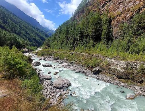
Tucked into a sheltered bowl high in the Gokyo Valley, Machhermo feels like a hidden mountain hideaway. A clear stream tumbles down from the slopes of Kyajo Ri and runs straight through the village, stone-walled yak pastures line the hillsides, and smoke curls from the chimneys of a few cosy teahouses. Just beyond the village rises the terminal moraine of the vast Ngozumpa Glacier, while the giant summit of Cho Oyu draws you onward. For trekkers bound for the Gokyo Lakes, Machhermo is the essential acclimatisation stop and a village with one of the most intriguing legends in the Himalaya. This complete guide from Nepal Trip Services covers Machhermo's location, altitude, routes, accommodation, views, history and practical tips for your Gokyo Lakes Trek.
Machhermo is a small village in the Khumbu region of Nepal. It lies in the Dudh Koshi River valley just north of Dole and south of Gokyo, at an altitude of about 4,470 m, just below the terminal moraine of the Ngozumpa Glacier.
The village sits inside Sagarmatha National Park and, like many Khumbu settlements, grew from a seasonal yak-herding pasture. Today, it's the last major settlement before Gokyo and one of the most important stops on the trail for safe acclimatisation.
| Detail | Information |
|---|---|
| Location | Gokyo Valley, Khumbu region, Solukhumbu District, Nepal |
| Altitude | About 4,470 m (14,665 ft); some sources list ~4,410 m |
| Protected Area | Sagarmatha National Park |
| Valley | Upper Dudh Koshi River valley |
| Famous For | Key acclimatisation stop, Cho Oyu views, 1974 yeti legend |
| Previous Stop | Dole (~4,040 m) |
| Next Stop | Gokyo (~4,790 m) |
| Walking Time from Dole | About 4–5 hours |
| Walking Time to Gokyo | About 3–5 hours |
| Accommodation | A handful of Sherpa teahouses |
| Best Time to Visit | March–May & September–November |
Machhermo plays a vital role in trekking safely to Gokyo:
During peak trekking seasons, Machhermo has hosted a seasonal rescue and aid post staffed by volunteer doctors, who often give free afternoon talks on altitude sickness: how to recognise it, prevent it and respond to it. These talks are one of the most valuable experiences on the trek.
Aid post operations have changed over the years, so ask your guide whether it's open during your visit. Either way, your guide will brief you on altitude safety and monitor your health daily.
Machhermo holds a special place in Himalayan folklore. In 1974, a young Sherpa woman herding yaks near the village reported being attacked by a creature she could not identify, which also killed several of her animals.
The story has never been verified, but it remains one of the most famous yeti accounts in the Khumbu, and locals are often happy to share their version of the tale over a cup of tea. It adds a touch of mystery to an already magical place.
| Section | Details |
|---|---|
| Dole → Lhabarma (~4,220–4,330 m) | Steady climb through scrub juniper |
| Lhabarma → Luza (~4,340–4,360 m) | Gentle trail through yak pastures |
| Luza → Machhermo (~4,470 m) | Trail along the valley side, high above the Dudh Koshi |
| Total | About 4.5–7 km, 4–5 hours (including rest) |
As you climb, trees give way to low shrubs and juniper. Behind you, Kangtega and Thamserku dominate the view, while Cho Oyu grows larger ahead.
On the return journey, the walk from Gokyo to Machhermo takes about 3 hours, mostly downhill along the lakes and valley.
| Mountain | Height | View |
|---|---|---|
| Cho Oyu | 8,188 m | First good views up the valley, especially from the ridge above the village |
| Kangtega | 6,783 m | Dramatic peak down the valley |
| Thamserku | 6,623 m | Towering behind you to the south |
| Kyajo Ri | 6,186 m | Rising above the village |
| Machhermo Peak | ~6,273 m | Nearby summit overlooking the valley |
A short hike up the ridge behind the village offers wider panoramic views and is great for acclimatisation.
Machhermo has a handful of Sherpa-run teahouses, many surprisingly comfortable for their altitude.
| Facility | Details |
|---|---|
| Rooms | Twin-sharing rooms with blankets |
| Bathrooms | Mostly shared; some lodges offer attached options |
| Hot Showers | Available, usually for a fee |
| Charging | Solar-powered, usually paid |
| Wi-Fi | Limited, typically via paid prepaid cards |
| Dining Hall | Warm room heated by a central stove |
Bring a four-season sleeping bag, as bedrooms are unheated and nights are cold.
Teahouses serve warming, energy-rich meals:
Choose vegetarian meals at this altitude for freshness and easier digestion.
| Season | Months | Day / Night (Approx.) | Conditions |
|---|---|---|---|
| Spring | March – May | 6–14°C / -8–0°C | Mild days, good views |
| Monsoon | June – August | 10–15°C / 2–6°C | Rain, clouds, slippery trails |
| Autumn | September – November | 5–12°C / -10 – -2°C | Clear skies, best mountain views |
| Winter | December – February | -2–6°C / -18 – -10°C | Very cold, possible snow, few trekkers |
Best overall: October–November and March–April.
| Permit | Foreign Nationals |
|---|---|
| Sagarmatha National Park Entry Permit | NPR 3,000 |
| Khumbu Pasang Lhamu Rural Municipality Permit | NPR 3,000 |
Permits are checked at Lukla and Monjo on the way into the Khumbu.
| Trek | Duration | Max Altitude |
|---|---|---|
| Gokyo Lakes Trek | 12 days | 5,357 m (Gokyo Ri) |
| Everest Three High Passes Trek | 18–20 days | 5,535 m |
| Gokyo & Everest Base Camp via Cho La Trek | 15–18 days | ~5,545 m |
| Renjo La Pass Trek | 14–16 days | 5,360 m |
Rest and acclimatise in peaceful Machhermo before reaching the turquoise lakes and breathtaking Everest panoramas of Gokyo Ri on our 12-day Gokyo Lakes Trek. For the classic journey to the foot of the world's highest mountain, choose the Classic Everest Base Camp Trek. Seasoned trekkers can tackle the Everest Three High Passes Trek, crossing Kongma La, Cho La and Renjo La, while those wanting a shorter adventure can enjoy Sherpa culture and Everest views on the Everest View Trek. Explore all our Everest Region adventures, and plan your perfect journey with our Trip Planner.
Machhermo is a small village in the Khumbu region of northeastern Nepal, inside Sagarmatha National Park. It lies in the upper Dudh Koshi valley, between Dole and Gokyo. The village sits just below the terminal moraine of the Ngozumpa Glacier. It's a key stop on the Gokyo Lakes trekking route.
Machhermo sits at about 4,470 metres (14,665 ft) above sea level. Some sources list slightly lower figures, around 4,410 metres. It's the last major settlement before Gokyo. At this altitude, acclimatisation is essential.
Machhermo allows a gradual altitude gain from Dole before reaching Gokyo at nearly 4,800 metres. Sleeping here helps your body adjust to thinner air. The shorter walking day gives extra time to rest. It reduces the risk of altitude sickness on the way to Gokyo Ri.
The trek from Dole to Machhermo takes about 4–5 hours, including rest stops. The trail climbs gradually through Lhabarma and Luza. Views of Cho Oyu, Kangtega and Thamserku accompany you. It's one of the more relaxed days on the Gokyo trek.
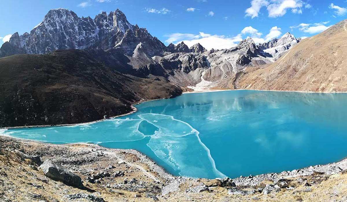
Gokyo is about 6–7 km from Machhermo, usually a 3–5 hour walk. The trail climbs onto the Ngozumpa Glacier's moraine and passes the first and second Gokyo Lakes. The scenery becomes more dramatic along the way. Most trekkers reach Gokyo by midday.
In 1974, a young Sherpa woman herding yaks near Machhermo reported being attacked by an unidentified creature that also killed several of her yaks. The story became one of the most famous yeti accounts in the Khumbu. It has never been verified. Locals still enjoy sharing the legend with trekkers.
A seasonal rescue and aid post has operated in Machhermo during peak seasons, staffed by volunteer doctors. They often give free afternoon talks on altitude sickness. Operations have changed over the years, so check with your guide. Serious cases may require helicopter evacuation.
Yes, Machhermo has several Sherpa-run teahouses offering twin-sharing rooms and warm dining halls. Some lodges have attached bathrooms. Hot showers, charging and Wi-Fi are available for a fee. Rooms are unheated, so bring a warm sleeping bag.
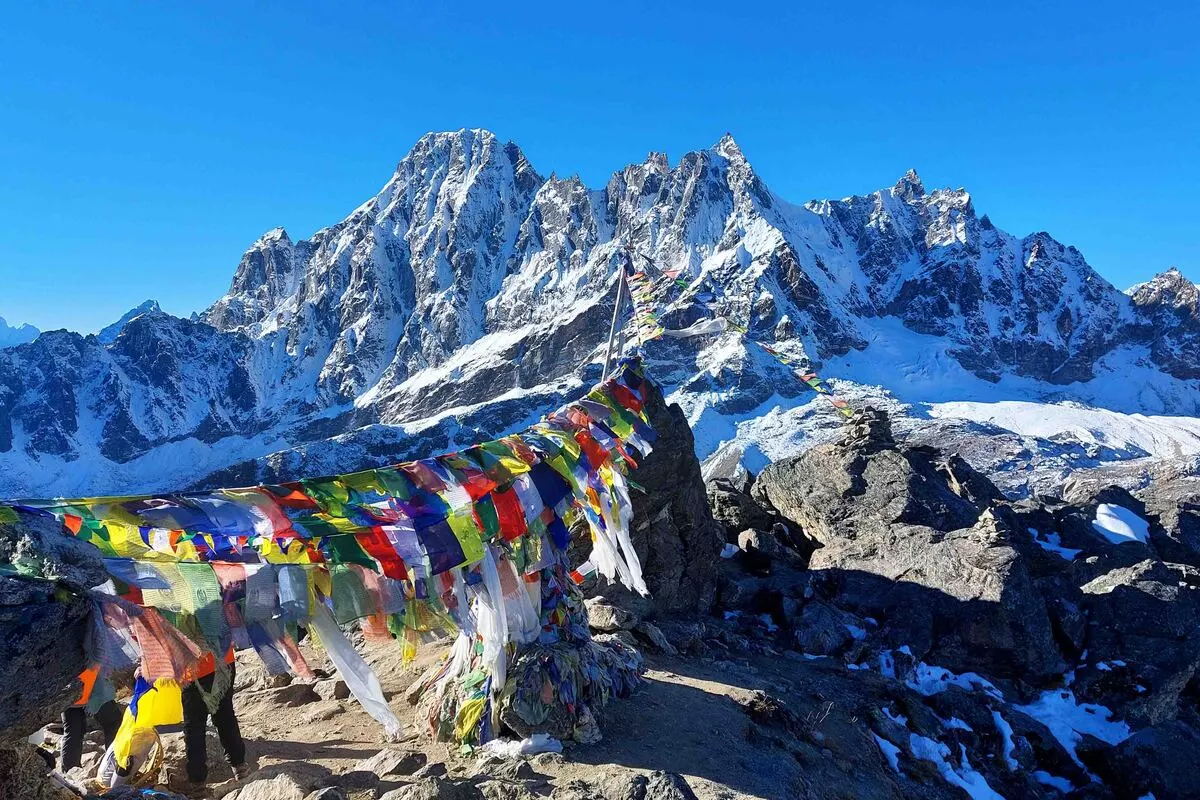
From Machhermo, you can see Cho Oyu up the valley, along with Kangtega, Thamserku, Kyajo Ri and Machhermo Peak. A short hike up the ridge behind the village offers even better views. Mornings are usually clearest. The scenery is a preview of what awaits at Gokyo.
Some trekkers may experience mild symptoms such as headache or breathlessness at Machhermo. Walking slowly, drinking plenty of water and resting well help reduce the risk. Report any symptoms to your guide immediately. Descend if symptoms worsen.
Yes, most teahouses offer solar-powered charging and limited Wi-Fi, usually for a fee. Wi-Fi often works through prepaid data cards. Connections can be slow or unreliable. Carry a power bank as a backup.
The best times are autumn (September–November) and spring (March–May). Autumn offers the clearest skies, while spring has milder temperatures. Winter is very cold with fewer trekkers. The monsoon brings rain and clouds.
Machhermo is cold at night year-round. In winter, temperatures can drop to around -18°C, while autumn nights are usually below freezing. Daytime temperatures are much milder in sunny weather. Warm layers and a four-season sleeping bag are essential.
Yes, you need the Sagarmatha National Park entry permit and the Khumbu Pasang Lhamu Rural Municipality permit. Both currently cost NPR 3,000 for foreign nationals. They're checked at Lukla and Monjo. Trekking companies usually arrange them in advance.
Machhermo lies on the Gokyo Lakes Trek and is also used on longer routes like the Everest Three High Passes Trek, the Gokyo–Cho La–EBC trek and the Renjo La Pass trek. It's the last major stop before Gokyo. Many trekkers also stay here on the return journey. It's a key part of any Gokyo adventure.
Machhermo may be small, but it's one of the most important stops on the way to the Gokyo Lakes. Set beside a sparkling mountain stream, surrounded by yak pastures and snow peaks, it offers the perfect place to rest, acclimatise and prepare for the high valley ahead. With its warm teahouses, valuable altitude lessons and intriguing yeti legend, Machhermo leaves a lasting impression on everyone who passes through.
Take your time here. Hike the ridge for views of Cho Oyu, enjoy a bowl of garlic soup by the stove and let your body adjust to the altitude. With experienced local guides and well-paced itineraries, Nepal Trip Services will help you journey safely through Machhermo and on to the breathtaking beauty of the Gokyo Valley.
Discover more articles that match your interests! Explore these similar blogs packed with insights, tips, and stories to keep you inspired.
Explore Nepal\'s Gokyo Valley: sacred turquoise lakes, Gokyo Ri, Ngozumpa Glacier, Sherpa villages, routes, best time, p...
Discover the Dudh Koshi River, Nepal\'s "Milk River" of Everest: its source, bridges, villages, trekking routes, best ti...
Explore Dole (4,040 m), the first stop in Nepal\'s Gokyo Valley. Discover routes, teahouses, mountain views, altitude ti...
Discover Nepal\'s sacred Gokyo Lakes: all six lakes explained, Gokyo Ri, routes, best time, permits, altitude tips & how...
Climb Gokyo Ri (5,357 m) for one of Nepal\\'s best Everest panoramas. Route, timing, difficulty, sunrise tips, views, pe...
Explore the Ngozumpa Glacier, the longest in the Himalaya. Discover its size, Spillway Lake, viewpoints, glacier crossin...