Dudh Koshi River, Nepal: Complete Travel & Trekking Guide
By Nepal Trip Services On 01 Oct 2026
By Nepal Trip Services On 01 Oct 2026
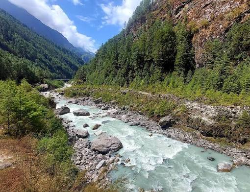
From the moment your plane lands in Lukla, one sound follows you through the Everest region: the roar of a powerful river rushing over boulders far below the trail. Its waters glow a pale, milky turquoise, swirling beneath prayer-flag-covered suspension bridges and racing past Sherpa villages, pine forests and towering peaks. This is the Dudh Koshi River, the "Milk River" of Everest and the lifeline of the Khumbu. Whether you're heading to Everest Base Camp or the turquoise lakes of the Gokyo Valley, the Dudh Koshi is your constant companion. This complete guide from Nepal Trip Services explores the river's source, course, bridges, villages, trekking routes and practical tips, including how to experience it on our Gokyo Lakes Trek.
The Dudh Koshi (दुधकोशी) is one of eastern Nepal's most important Himalayan rivers. Its name comes from Nepali: dudh means milk and koshi means river, so it is called the "Milk River" because its fast-flowing waters often look milky white, coloured by fine rock dust carried down from the glaciers.
The river flows south from the high glaciers of the Everest (Khumbu) region through Solukhumbu District, carving deep gorges before joining the Sun Koshi. Its valley forms the main trekking corridor into the Everest region, linking Lukla, Phakding and Namche Bazaar.
| Detail | Information |
|---|---|
| Meaning | "Milk River" |
| Location | Solukhumbu District, eastern Nepal |
| Main Source | Ngozumpa Glacier area, Gokyo Valley |
| Length | About 130 km (81 miles) |
| Major Tributaries | Imja Khola, Bhote Koshi, streams from the Gokyo Lakes |
| Joins | Sun Koshi near Harkapur, Okhaldhunga District |
| River System | Dudh Koshi → Sun Koshi → Saptakoshi → Koshi → Ganges |
| Protected Area | Upper course within Sagarmatha National Park |
| Famous Bridge | Hillary Suspension Bridge |
| Main Treks | Gokyo Lakes Trek, Everest Base Camp Trek, Three High Passes Trek |
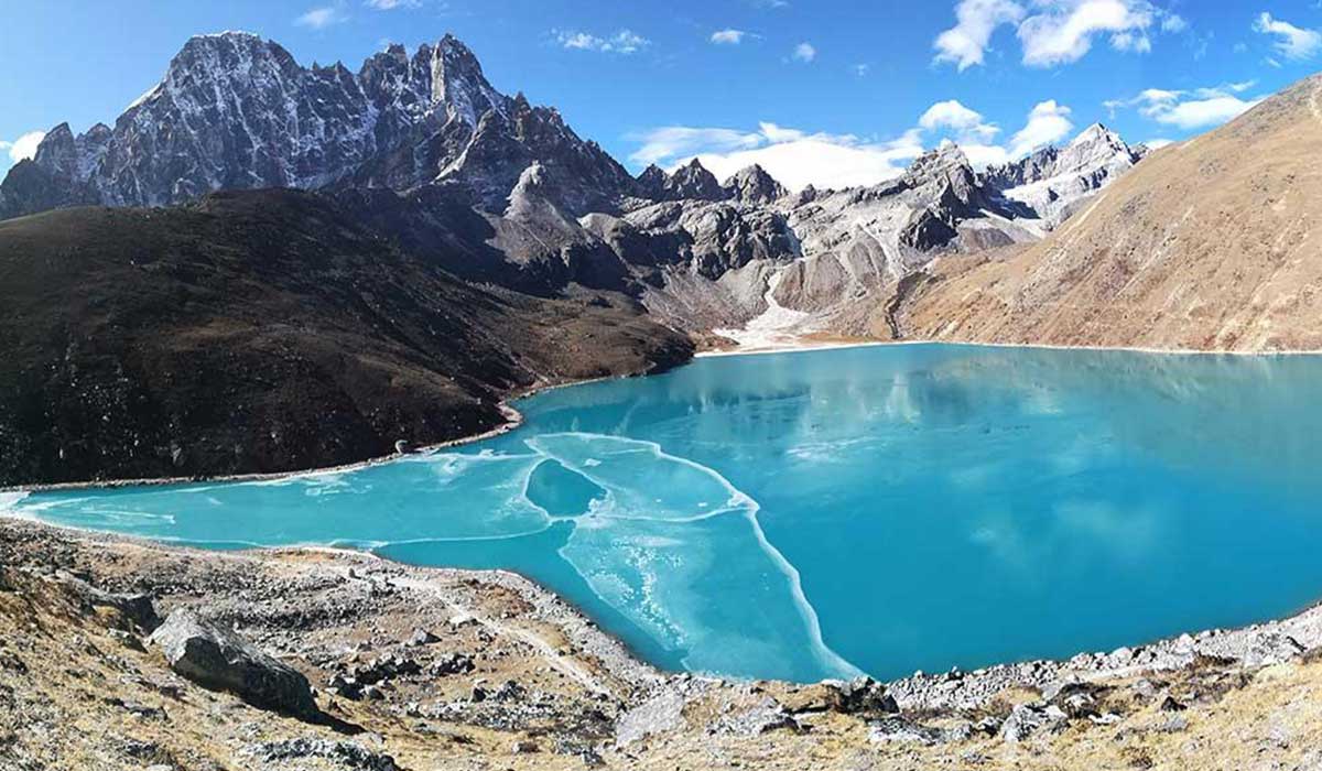
The Dudh Koshi originates from the Ngozumpa Glacier in the Gokyo Valley and flows south through the Everest region. Its main source lies to the east of the Gokyo Lakes, where glacial meltwater gathers beneath the slopes of Cho Oyu.
As it flows south, the river is joined by important tributaries:
Did you know? When you trek through the Gokyo Valley, you're walking beside the very birthplace of the Dudh Koshi.
| Section | Highlights |
|---|---|
| Upper Dudh Koshi (Gokyo Valley) | Glacial streams beside the Ngozumpa Glacier and turquoise lakes |
| Phortse Thanga & Dole | Fast-flowing river in a deep, forested valley |
| Namche & Larja Dobhan | Confluence with the Bhote Koshi beneath the Hillary Bridge |
| Monjo, Phakding & Lukla | Main trekking corridor with Sherpa villages and suspension bridges |
| Lower Solukhumbu | Deep gorges and terraced hills |
| Harkapur (Okhaldhunga) | Confluence with the Sun Koshi, forming part of the Saptakoshi system |
Ultimately, the Dudh Koshi's waters travel through the Saptakoshi and Koshi rivers into India, joining the Ganges before reaching the Bay of Bengal.
Crossing the Dudh Koshi on swaying suspension bridges is one of the most memorable parts of trekking in the Everest region.
| Bridge | Location | Highlight |
|---|---|---|
| Hillary Suspension Bridge | Between Jorsalle and Namche Bazaar | The highest and most iconic bridge on the trail, draped in prayer flags |
| Phakding Bridge | Phakding village | Crosses the river beside teahouses and mani walls |
| Benkar Bridge | Near Benkar | Views of waterfalls and rushing rapids |
| Monjo Bridge | Near the Sagarmatha National Park gate | Entry point to the national park |
| Chheplung Bridge | Below Lukla | One of the first bridges trekkers cross |
Safety tip: Always give way to yaks and porters on bridges, and wait on the uphill side of the trail when they pass.
| Village | Altitude | Highlights |
|---|---|---|
| Lukla | 2,860 m | Gateway airport to the Everest region |
| Phakding | ~2,610–2,650 m | Riverside teahouses, first overnight stop |
| Benkar | ~2,700 m | Waterfalls and peaceful river views |
| Monjo | ~2,840 m | Sagarmatha National Park entry gate |
| Jorsalle | ~2,740 m | Last riverside village before Namche |
| Namche Bazaar | 3,440 m | Sherpa capital above the river valley |
| Phortse Thanga | ~3,680 m | Riverside stop on the Gokyo route |
| Dole & Machhermo | ~4,040–4,470 m | Upper valley settlements toward Gokyo |
The Dudh Koshi valley is the backbone of the Everest region's trekking network.
| Trek | Duration | Max Altitude | How It Follows the River |
|---|---|---|---|
| Gokyo Lakes Trek | 12 days | 5,357 m | Follows the Dudh Koshi all the way to its source in the Gokyo Valley |
| Classic Everest Base Camp Trek | 14 days | ~5,545 m | Follows the river from Lukla to Namche, then the Imja Khola toward EBC |
| Everest Three High Passes Trek | 18–20 days | 5,535 m | Explores the Dudh Koshi, Imja and Bhote Koshi valleys |
| Everest View Trek | 5–7 days | ~3,880 m | Short trek along the lower Dudh Koshi to Namche and viewpoints |
| Island Peak Climbing | 16–19 days | 6,189 m | Follows the river before heading up the Imja valley |
Our Gokyo Lakes Trek offers one of the most complete Dudh Koshi experiences:
In 1953, Edmund Hillary and Tenzing Norgay travelled through the Dudh Koshi valley on their way to the first successful ascent of Mount Everest. Today, thousands of trekkers and climbers follow the same historic route each year.
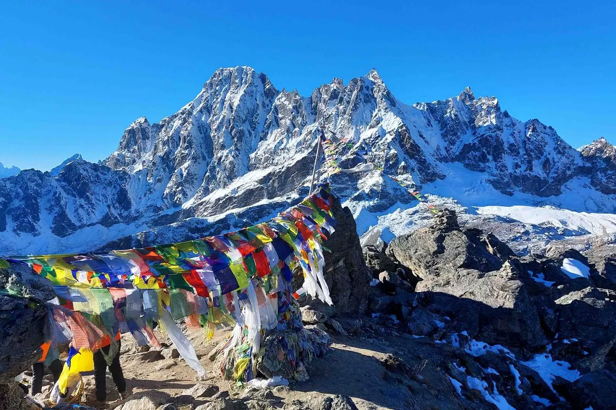
The Dudh Koshi holds spiritual importance for the Sherpa and Rai communities who live along its banks. Mani walls, chortens and prayer flags line the river's trails, reflecting deep Buddhist traditions. The Gokyo Lakes at its source are sacred to both Hindus and Buddhists.
The river supports farming, livestock and micro-hydropower projects that bring electricity to remote mountain villages. It also sustains the region's rich forests and wildlife.
The Dudh Koshi is one of Nepal's most extreme whitewater rivers, with powerful, steep rapids fed by glacial meltwater. Expedition-style rafting and kayaking have been attempted on sections of the river, but it is suitable only for highly experienced paddlers on specialist trips. It is not a recreational rafting river for typical travellers.
| Season | Months | River & Trail Conditions | Rating |
|---|---|---|---|
| Autumn | September – November | Clear skies, milky-blue river, stable weather | Best |
| Spring | March – May | Blooming rhododendrons, rising meltwater | Excellent |
| Winter | December – February | Cold, clear and quiet; lower water levels | Good |
| Monsoon | June – August | Swollen river, rain, landslides, flight delays | Difficult |
| Permit | Foreign Nationals |
|---|---|
| Sagarmatha National Park Entry Permit | NPR 3,000 |
| Khumbu Pasang Lhamu Rural Municipality Permit | NPR 3,000 |
Both permits are included in our Gokyo Lakes Trek package.
Follow the Dudh Koshi from the bustling trails of Lukla all the way to its glacial source on our 12-day Gokyo Lakes Trek, where turquoise lakes, the mighty Ngozumpa Glacier and the stunning Gokyo Ri panorama await. Prefer to stand at the foot of the world's highest mountain? Trace the river's path toward Everest on the Classic Everest Base Camp Trek, crossing the famous Hillary Bridge and exploring Sherpa villages along the way. For experienced trekkers seeking the ultimate challenge, the Everest Three High Passes Trek crosses Kongma La, Cho La and Renjo La for unmatched Himalayan views, while the Everest View Trek offers a shorter, easier journey along the lower Dudh Koshi with breathtaking Everest panoramas. Explore all our Everest Region adventures, and plan your perfect journey with our Trip Planner.
Dudh Koshi means "Milk River" in Nepali, from dudh (milk) and koshi (river). The name comes from the river's milky-white colour, caused by fine glacial rock dust. Its water often appears pale turquoise or grey. It's one of the most famous rivers in Nepal.
The Dudh Koshi begins near the Ngozumpa Glacier in the Gokyo Valley, east of the Gokyo Lakes. It's fed by meltwater from glaciers beneath Cho Oyu and surrounding peaks. Tributaries like the Imja Khola and Bhote Koshi join it further downstream. The Gokyo Lakes Trek takes you close to its source.
The Dudh Koshi is about 130 km (81 miles) long. It flows from the Gokyo Valley through Solukhumbu District to its confluence with the Sun Koshi. Along the way, it drops thousands of metres through deep gorges. It's one of the highest-source rivers in Nepal.
The Dudh Koshi joins the Sun Koshi near Harkapur in Okhaldhunga District. Together, they become part of the Saptakoshi river system. The water eventually flows into the Koshi River and then the Ganges in India. It finally reaches the Bay of Bengal.
The Gokyo Lakes Trek, Everest Base Camp Trek, Everest Three High Passes Trek, Everest View Trek and Island Peak climbs all follow the Dudh Koshi. The river valley is the main route between Lukla and Namche Bazaar. The Gokyo Lakes Trek follows it all the way to its source. It's the backbone of Everest region trekking.
The Hillary Suspension Bridge is a famous high bridge across the Dudh Koshi between Jorsalle and Namche Bazaar. It's draped in prayer flags and offers dramatic views of the river gorge. It's one of the most photographed spots in the Everest region. Crossing it is a highlight for many trekkers.
Trekkers cross several suspension bridges over the Dudh Koshi between Lukla and Namche Bazaar. On the Everest Base Camp trek, trekkers cross around nine suspension bridges in total. The most famous is the Hillary Bridge. Each crossing offers great views of the rushing river.
No, swimming in the Dudh Koshi is extremely dangerous. The water is freezing cold, and the current is very powerful. Riverbanks can also be unstable. Enjoy the river safely from the trail and bridges.
The Dudh Koshi is an extreme whitewater river suitable only for highly experienced kayakers and rafters on expedition-style trips. Its steep, powerful rapids are not suitable for recreational rafting. Most travellers enjoy the river while trekking. Nepal offers other rivers better suited for rafting.
Yes, the Dudh Koshi holds spiritual importance for the Sherpa and Rai communities. Prayer flags, mani walls and chortens line its trails. The Gokyo Lakes at its source are sacred to both Hindus and Buddhists. Visitors should respect local customs along the river.
The best times are autumn (September–November) and spring (March–May). Autumn offers clear skies, while spring brings blooming rhododendrons. Winter is quiet but cold. The monsoon brings rain, high water and flight delays.
Yes, you need the Sagarmatha National Park entry permit and the Khumbu Pasang Lhamu Rural Municipality permit. Both currently cost NPR 3,000 for foreign nationals. Permits are checked at Lukla and Monjo. Trekking companies usually arrange them in advance.
Yes, Edmund Hillary and Tenzing Norgay travelled through the Dudh Koshi valley in 1953 on their way to the first ascent of Everest. Their route closely follows today's popular trekking trail. The Hillary Bridge is named in honour of Sir Edmund Hillary. Trekkers today walk in their footsteps.
The valley is home to Himalayan tahr, musk deer, langur monkeys and many bird species, including the colourful Danphe. Forests of pine, rhododendron and birch line the riverbanks. Spring is a great time for wildlife and flowers. Keep noise low to increase your chances of sightings.
The best way is to trek through the Everest region, especially on the Gokyo Lakes Trek or Everest Base Camp Trek. You'll walk beside the river, cross its famous bridges and visit villages along its banks. The Gokyo Lakes Trek even takes you to its source. Book with Nepal Trip Services for a guided experience.
The Dudh Koshi River is the heartbeat of the Everest region. Born from the glaciers of the Gokyo Valley, it rushes past Sherpa villages, beneath prayer-flag-covered bridges and through deep Himalayan gorges, carrying with it the stories of mountaineers, traders and pilgrims. For trekkers, it's more than a river; it's a guide, a companion and a symbol of the wild beauty of the Khumbu.
Whether you cross the iconic Hillary Bridge on the way to Everest Base Camp or follow the Milk River all the way to its glacial source, the Dudh Koshi will be part of your journey from the very first step. To experience it from Lukla to the turquoise lakes of Gokyo, join our Gokyo Lakes Trek and let Nepal Trip Services guide you along one of the most spectacular river valleys on Earth.
Discover more articles that match your interests! Explore these similar blogs packed with insights, tips, and stories to keep you inspired.
Explore Nepal\'s Gokyo Valley: sacred turquoise lakes, Gokyo Ri, Ngozumpa Glacier, Sherpa villages, routes, best time, p...
Explore Dole (4,040 m), the first stop in Nepal\'s Gokyo Valley. Discover routes, teahouses, mountain views, altitude ti...
Explore Machhermo (4,470 m), the key acclimatisation stop before Gokyo. Discover routes, teahouses, Cho Oyu views, altit...
Discover Nepal\'s sacred Gokyo Lakes: all six lakes explained, Gokyo Ri, routes, best time, permits, altitude tips & how...
Climb Gokyo Ri (5,357 m) for one of Nepal\\'s best Everest panoramas. Route, timing, difficulty, sunrise tips, views, pe...
Explore the Ngozumpa Glacier, the longest in the Himalaya. Discover its size, Spillway Lake, viewpoints, glacier crossin...