Kali Gandaki Gorge, Nepal: Complete Travel & Trekking Guide
By Nepal Trip Services On 25 Sep 2026
By Nepal Trip Services On 25 Sep 2026
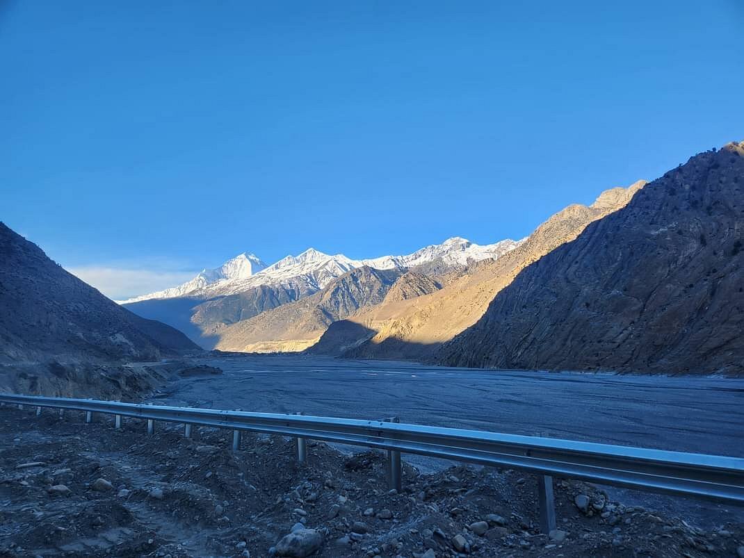
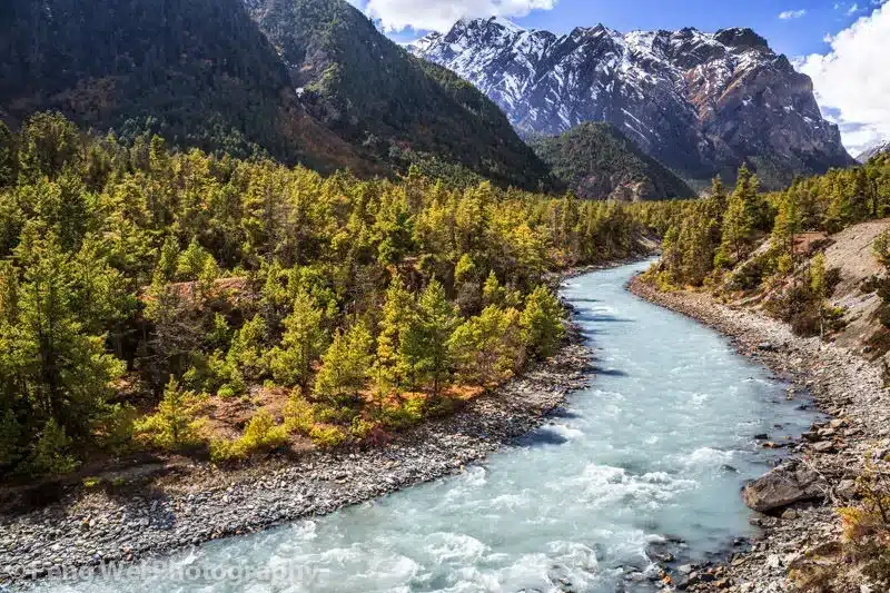
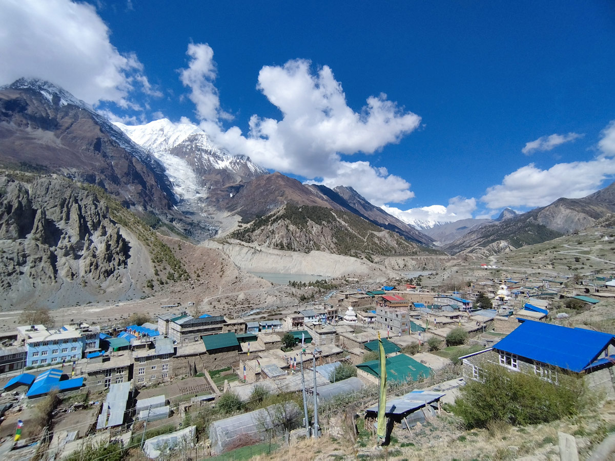
Between two Himalayan giants lies a canyon so deep that geologists consider it the deepest gorge on Earth. The Kali Gandaki Gorge slices through the mountains separating Dhaulagiri and Annapurna, two peaks that soar above 8,000 meters, while the Kali Gandaki River continues to carve its ancient path far below. For travelers exploring Nepal's Annapurna Circuit Trek, this gorge isn't just scenery — it's the geological centerpiece of one of the most celebrated trekking regions in the world. This guide breaks down everything you need to know before visiting, from how the gorge was formed to the villages, permits, and practical logistics involved in exploring it.
The Kali Gandaki Gorge is a massive canyon formed by the Kali Gandaki River as it cuts through the Himalayas between Dhaulagiri (8,167m) to the west and Annapurna (8,091m) to the east. Locally known as Andha Galchi, the gorge is measured not by conventional rim-to-floor depth, but by the difference between the river's elevation and the height of the tallest peaks flanking it — a method that places it firmly among the deepest canyons on the planet.
| Category | Detail |
|---|---|
| Deepest point elevation | ~2,520 meters (8,270 feet) at the river |
| Depth measurement | ~5,571 meters (18,278 feet) below Annapurna I's summit |
| Flanking peaks | Dhaulagiri (west), Annapurna (east) |
| River origin | Near the Tibetan border, at the Ganges-Brahmaputra watershed divide |
| Local name | Andha Galchi |
| Historic name (upper section) | Thak Khola |
| Provinces/Districts | Mustang and Myagdi, Gandaki Province |
| Trekking association | Core section of the Annapurna Circuit and Poon Hill trails |
Unlike most canyons, which are simply cut by rivers flowing through existing terrain, the Kali Gandaki Gorge has a more unusual origin story rooted in geologic timing:
This rare combination — an ancient river actively racing uplift — is part of what makes the Kali Gandaki Gorge such a geological standout, even among the world's great canyons.
The Kali Gandaki River travels a long and varied path before reaching its deepest point, passing through several distinct zones:
Long before trekkers arrived, the Kali Gandaki Gorge functioned as a vital trans-Himalayan trade route connecting Tibet and India. This history shaped the communities that still line the trail today:
There are two main trekking approaches that bring travelers into direct contact with the Kali Gandaki Gorge, each suited to different time frames and goals:
| Route | Starting Point | Duration | Highlights |
|---|---|---|---|
| Annapurna Circuit Trek | Besisahar | 12–15 days | Full circuit over Thorong La Pass, passing through the gorge near Jomsom, Marpha, and Tukuche |
| Poon Hill / Ghorepani Trek | Nayapul (via Pokhara) | 4–5 days | Shorter trek with sunrise views of Annapurna and Dhaulagiri, connecting into the gorge region |
Both routes fall within the Annapurna Conservation Area and offer different levels of immersion — the full circuit provides the deepest engagement with the gorge and surrounding Mustang culture, while the Poon Hill route offers a quicker taste of the same dramatic scenery.
| Season | Months | What to Expect |
|---|---|---|
| Spring | March – May | Warmer temperatures, clear mountain views, blooming rhododendrons at lower elevations |
| Autumn | September – November | The most popular season, with the clearest skies and most stable weather |
| Winter | December – February | Cold, occasional snow at higher points, quieter trails |
| Monsoon | June – August | Drier than much of Nepal due to the rain shadow effect, though visibility can be inconsistent |
Because the gorge sits partly within a rain shadow zone, it experiences noticeably less monsoon rainfall than many other trekking regions in Nepal, making it a comparatively reliable option even during summer months.
Trekking through the gorge as part of the Annapurna Circuit or Poon Hill routes requires the following documentation:
Both permits are obtainable in Kathmandu or Pokhara and are checked at trailhead checkpoints along the route.
| Factor | Kali Gandaki Gorge | Grand Canyon (USA) | Colca Canyon (Peru) |
|---|---|---|---|
| Depth measurement method | River-to-peak elevation difference | Rim-to-river depth | Rim-to-river depth |
| Approximate depth | 5,571 meters (18,278 feet) | ~1,800 meters | ~3,270 meters |
| Flanking terrain | Two 8,000m+ Himalayan peaks | Colorado Plateau | Andes Mountains |
| Primary access | Multi-day trekking | Road access and day hikes | Road access and day hikes |
The gorge runs through the Mustang and Myagdi districts of Gandaki Province in north-central Nepal, cutting between the peaks of Dhaulagiri and Annapurna. It lies within the broader Annapurna region, making it easily accessible from popular trekking hubs like Pokhara and Jomsom.
Its depth is measured by the difference between the river's elevation and the height of the surrounding peaks, rather than a simple rim-to-floor measurement used for most canyons. By this method, the gorge reaches roughly 5,571 meters below the summit of Annapurna I, a scale unmatched by any other canyon on Earth.
The Kali Gandaki River is actually older than the Himalayas themselves, meaning it was already flowing through this landscape before the surrounding mountains rose around it. As tectonic activity pushed Dhaulagiri and Annapurna upward over millions of years, the river continuously cut downward at a matching pace, resulting in the dramatic, deep canyon seen today.
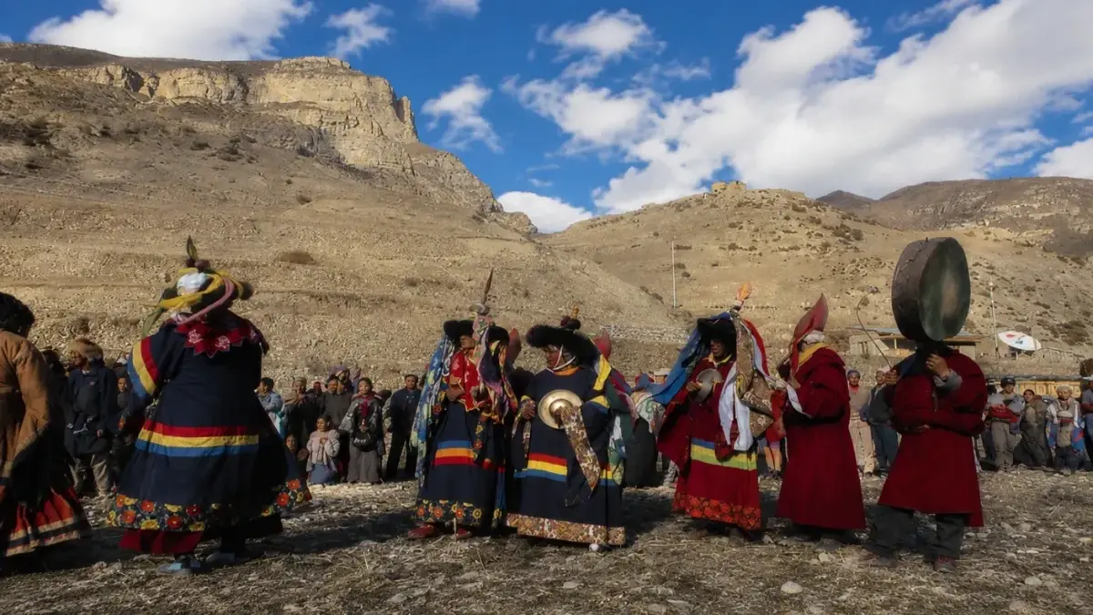
The gorge is locally known as Andha Galchi, while its upper section carries the name Thak Khola, after the Thakali people who built prosperous trading communities along this route. These names reflect centuries of local history that predate the gorge's modern recognition as a trekking destination.
Dhaulagiri rises to 8,167 meters on the western side, while Annapurna stands at 8,091 meters to the east, making the gorge a rare passage squeezed directly between two of the world's fourteen 8,000-meter peaks. This proximity to such massive elevations is exactly what gives the gorge its record-setting depth measurement.
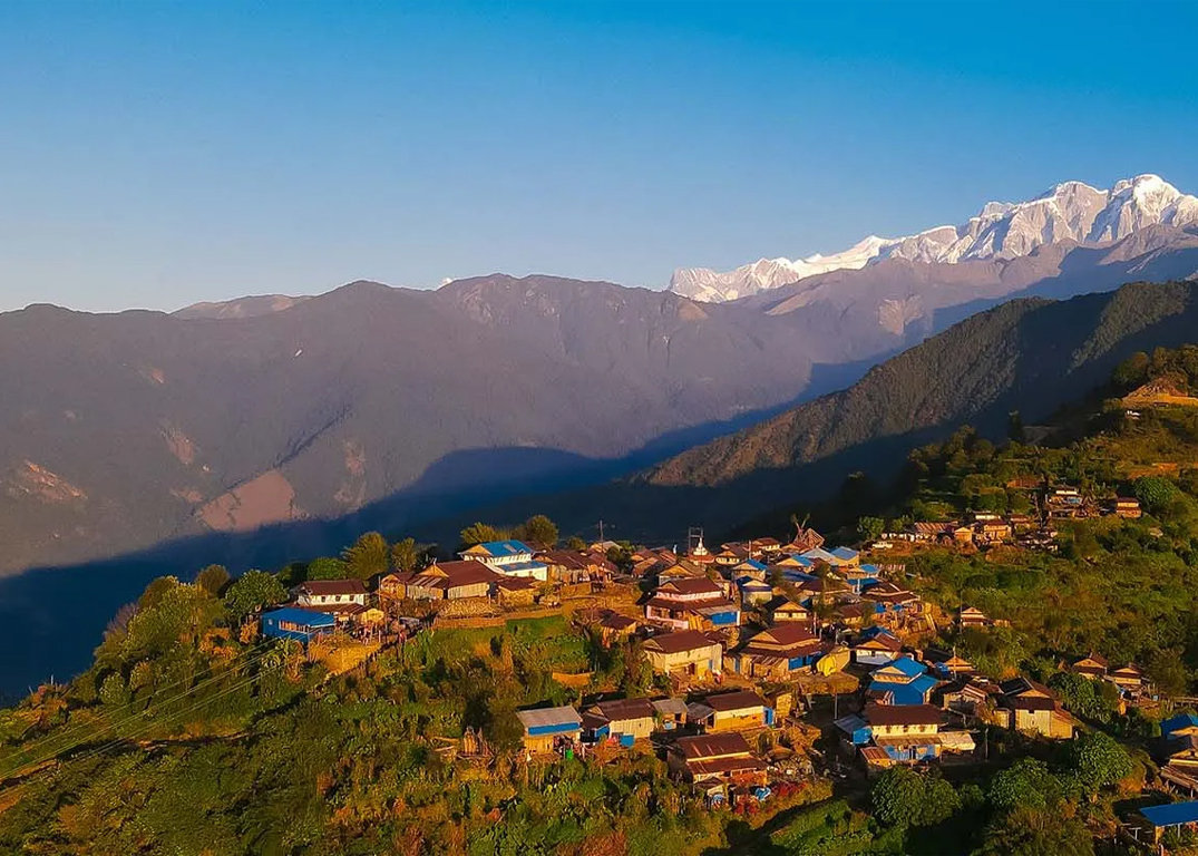
Notable villages along the route include Tatopani, Ghasa, Marpha, Tukuche, Jomsom, and Kagbeni, each offering a distinct blend of culture, architecture, and hospitality. These settlements developed historically as trade stops, and many still reflect traditional Thakali and Mustang-influenced building styles today.
The full Annapurna Circuit Trek and the shorter Poon Hill/Ghorepani trek both bring trekkers directly through the gorge region, though each offers a different level of immersion. The circuit trek provides deeper engagement with the gorge and surrounding Mustang culture, while the Poon Hill route offers a quicker, lower-altitude alternative for those with limited time.
Tatopani is famous for its natural hot springs, which have long served as a welcome rest stop for trekkers looking to soothe tired muscles after days of walking through the gorge. The name itself translates to "hot water" in Nepali, and the springs remain one of the most relaxing highlights along the entire route.
Shaligram fossils are ammonite stones found along the riverbed of the Kali Gandaki, formed millions of years ago when the region was still part of an ancient sea. Hindus consider these fossils sacred, revering them as a non-living form of Lord Vishnu, and pilgrims sometimes collect them during their journey through the gorge.
Trekkers need an Annapurna Conservation Area Permit (ACAP) and a Trekkers' Information Management System (TIMS) card, both of which are required for entry into the conservation area surrounding the gorge. These permits can be arranged in advance in Kathmandu or Pokhara and are checked at various checkpoints along the trail.
Spring, from March to May, and autumn, from September to November, offer the clearest skies, most stable weather, and best overall visibility for viewing the surrounding peaks. These seasons also tend to have the most reliable trail conditions, making them the most popular times for trekkers to attempt the route.
No, the gorge lies partly within a rain shadow created by the surrounding Himalayan peaks, so it experiences noticeably less monsoon rainfall than many other parts of Nepal. This makes the region a somewhat more viable summer trekking option compared to areas further south, though trail conditions can still vary.
Yes, the gorge is well known for funneling strong winds, particularly during the afternoon hours, due to the narrow channel created between Dhaulagiri and Annapurna. Because of this, trekkers are often advised to start early in the day and complete exposed sections before the winds pick up.
Yes, many trekkers choose to pair a visit to the Kali Gandaki Gorge with a trip to the nearby sacred site of Muktinath, since the two destinations are geographically close along the same general route. Combining both offers a fuller experience that blends dramatic natural scenery with one of Nepal's most significant pilgrimage sites.
The gorge offers a rare combination of record-setting geology, centuries of trading history, and some of the most dramatic Himalayan scenery found anywhere in Nepal. Walking through a canyon carved between two 8,000-meter peaks provides a humbling sense of scale that few other trekking destinations in the world can match.
The Kali Gandaki Gorge is far more than a scenic backdrop — it's a living record of geological time, ancient trade, and cultural resilience, all carved into one of the most dramatic landscapes in the Himalayas. From the moment the trail reveals Dhaulagiri and Annapurna towering on either side, it becomes clear why this gorge continues to capture the imagination of trekkers and geologists alike. Whether you're passing through as part of the full Annapurna Circuit Trek or a shorter regional excursion, walking through the world's deepest gorge remains one of the most humbling and unforgettable experiences Nepal has to offer.
Discover more articles that match your interests! Explore these similar blogs packed with insights, tips, and stories to keep you inspired.
Everything on Thorong La Pass — altitude, difficulty, weather, route & crossing times. Complete guide for the Annapurn...
Complete guide on how to prepare for the Annapurna Circuit Trek — training, gear, permits, insurance & mental readines...
Discover Besisahar, Nepal — the official gateway to the Annapurna Circuit Trek. Complete guide to altitude, history & ...
Discover the Marsyangdi River — the Annapurna Circuit\'s raging river. Complete guide to its geography, origins & trek...
Discover Manang, Nepal — Annapurna Circuit\\'s key acclimatization village with monasteries, glacial lakes & Thorong L...
Explore Manangi culture in Nepal — Tibetan Buddhist heritage, trans-Himalayan trading history & unique lifestyle of th...