Kali Gandaki River, Nepal: Complete Travel & Cultural Guide
By Nepal Trip Services On 25 Sep 2026
By Nepal Trip Services On 25 Sep 2026
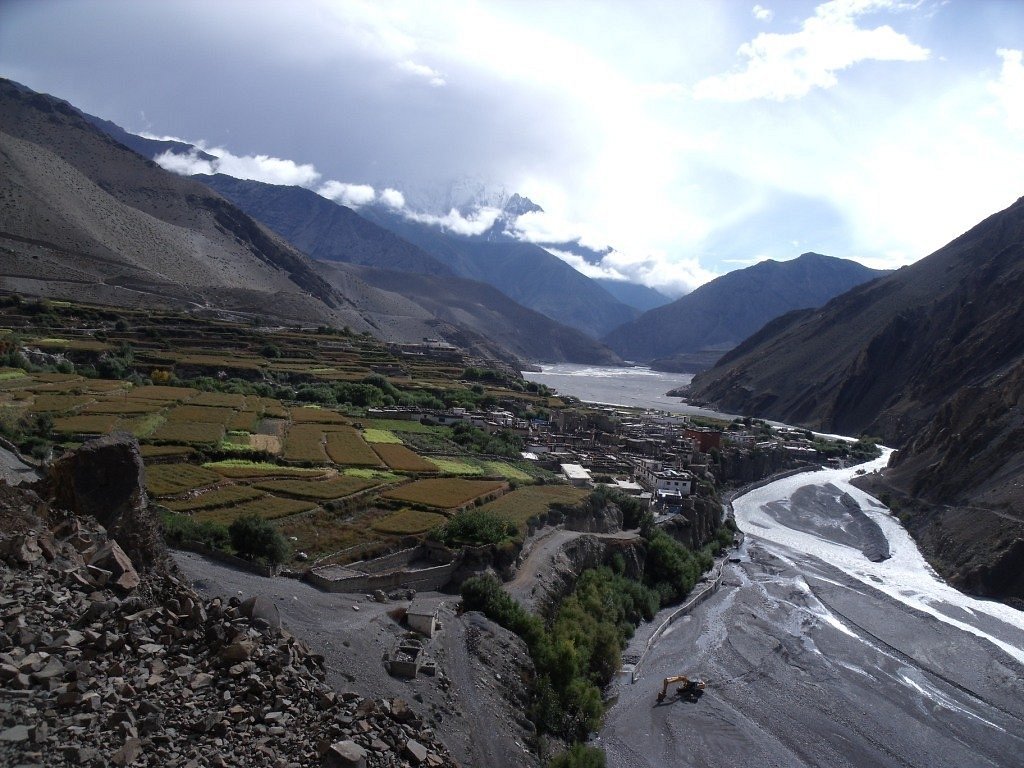
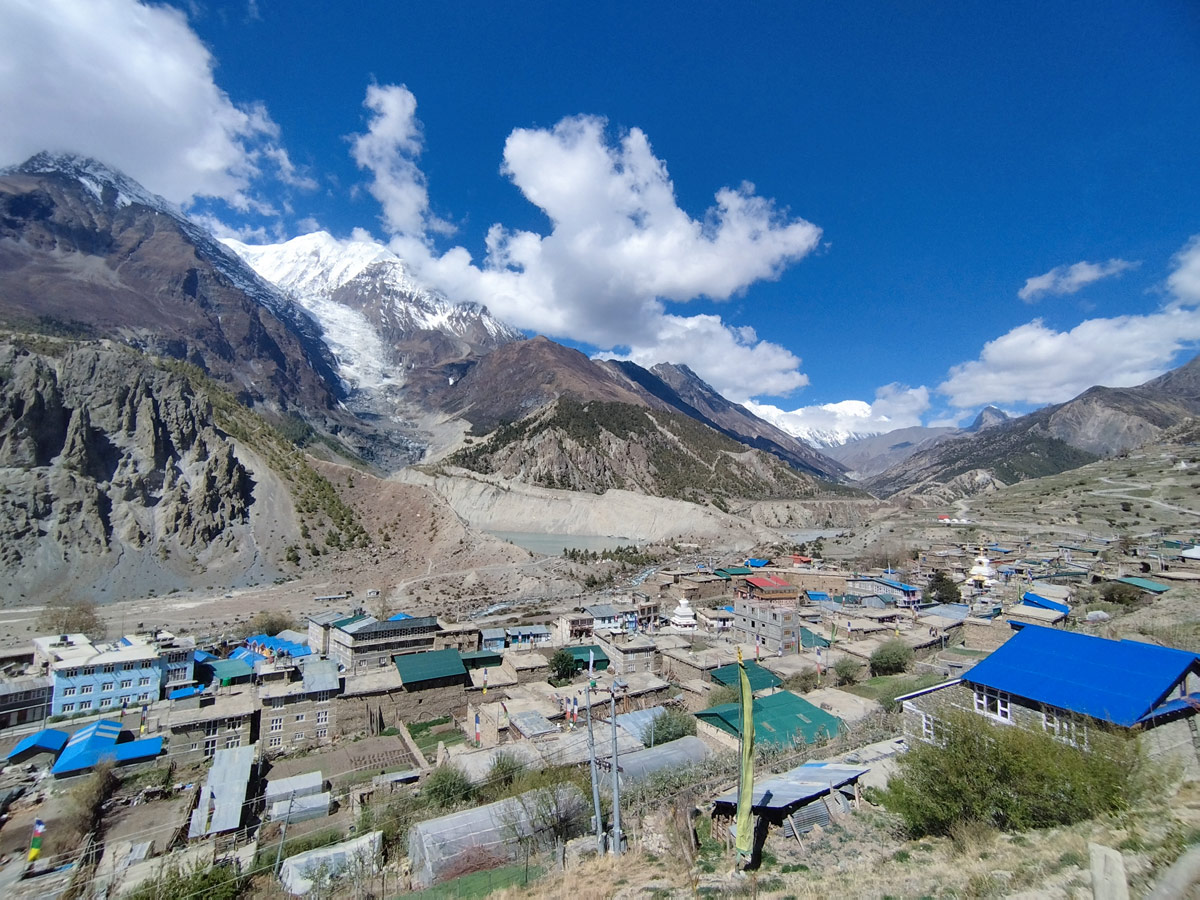
Flowing from a Himalayan glacier near the Tibetan border down through one of the deepest gorges on Earth, the Kali Gandaki River is far more than a geographic feature — it's a sacred waterway, an ancient trade corridor, and one of the defining natural forces shaping Nepal's Mustang and Annapurna regions. Older than the very mountains it flows between, this remarkable river has carved a canyon separating two 8,000-meter peaks while carrying deep religious significance for millions of Hindus and Buddhists across South Asia. For travelers exploring the Annapurna Circuit Trek, the river forms the geographic and spiritual backbone of the entire journey. This complete guide explores its geography, mythology, cultural importance, and practical travel information.
The Kali Gandaki River is a major river in Nepal, forming the primary right-bank tributary of the larger Gandaki River system, which itself flows into the Ganges in India. Known locally by several names along its course, including Mustang Khola and simply Gandaki in its upper reaches, the river is famous for the dramatic gorge it has carved between the Dhaulagiri and Annapurna massifs, along with its deep spiritual significance in Hindu tradition.
| Feature | Details |
|---|---|
| Source | Nhubine Himal Glacier, Mustang District, Nepal |
| Source Elevation | 6,268 meters (20,564 feet) |
| Total River System Length | Approximately 630 kilometers (as part of the Gandaki River) |
| Deepest Gorge Point | ~2,520 meters elevation, near Tukuche |
| Flanking Peaks | Dhaulagiri (8,167m) and Annapurna I (8,091m) |
| Major Tributary | Jhong Khola (Kak Khola), descending from Muktinath |
| Eventually Becomes | The Narayani River, after joining the Trishuli near Devghat |
| Final Destination | Joins the Ganges River at Sonpur, India |
The Kali Gandaki originates at the Nhubine Himal Glacier, located at an elevation of 6,268 meters in the Mustang District of Nepal, near the border with Tibet. In its earliest stretches, the river is fed by two headwater streams, sometimes referred to as the Nup Chhu and Shar Chhu ("West River" and "East River"), which meet near the historic town of Lo Manthang in Upper Mustang.
From there, the river flows southwest, historically labeled as Mustang Khola on older maps, passing through a sheer-sided canyon before widening near the village of Chele. At Kagbeni, a significant tributary known as the Jhong Khola, Kak Khola, or sometimes referred to by other local names, descends from the sacred site of Muktinath and joins the main river. From this confluence point onward, the river is consistently referred to as the Kali Gandaki on modern maps.
South of Kagbeni, the river enters its most dramatic and famous stretch: the Kali Gandaki Gorge, also known locally as Andha Galchi. This gorge lies between two towering Himalayan giants:
Measured by the difference between the river's elevation and the height of the surrounding peaks, this gorge is considered the deepest in the world. At its deepest point, roughly 7 kilometers downstream from Tukuche, the river sits at an elevation of approximately 2,520 meters, more than 5,500 meters lower than the summit of Annapurna I.
One of the most remarkable geological facts about the Kali Gandaki is that the river itself is older than the mountains surrounding it. This unusual relationship developed through the following process:
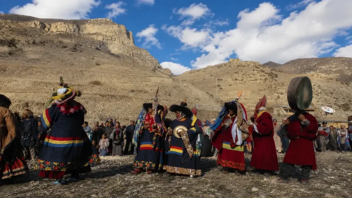
Beyond its geological importance, the Kali Gandaki holds profound spiritual meaning across multiple religious traditions:
The Kali Gandaki flows past several historically and culturally significant settlements as it winds through the Mustang and Annapurna regions:
| Village/Town | Notable Features |
|---|---|
| Lo Manthang | Ancient walled capital of Upper Mustang, near the river's headwaters |
| Kagbeni | Historic gateway village, confluence with the Jhong Khola |
| Jomsom | Administrative hub of Mustang District, situated directly on the riverbank |
| Marpha | Famous for apple orchards and Thakali culture |
| Tukuche | Historic trading town near the gorge's deepest point |
| Tatopani | Known for natural hot springs downstream of the gorge |
| Beni | Lower valley town where the river continues toward the Terai plains |
After passing through the dramatic gorge and lower hill villages, the Kali Gandaki continues its journey toward the plains of Nepal and eventually into India:
The river valley forms the backbone of several major trekking routes in the Annapurna and Mustang regions, offering travelers direct access to its most dramatic and culturally rich sections.
| Season | Months | Conditions |
|---|---|---|
| Spring | March – May | Mild temperatures, good visibility, pleasant trekking conditions |
| Autumn | September – November | Clearest skies, most popular season for trekking and pilgrimage |
| Winter | December – February | Cold temperatures, occasional snow at higher elevations |
| Monsoon | June – August | Drier than much of Nepal due to the rain shadow effect, though winds remain strong |
Because much of the Kali Gandaki valley lies within a rain shadow created by the surrounding Himalayan peaks, the region experiences noticeably less monsoon rainfall than many other parts of Nepal.
| Factor | Kali Gandaki | Trishuli River | Koshi River |
|---|---|---|---|
| Source | Nhubine Himal Glacier | Central Nepal Himalayas | Confluence of seven Himalayan streams |
| Known For | World's deepest gorge, Shaligram fossils | Popular for white-water rafting | Nepal's largest river by volume |
| Cultural Significance | Sacred Hindu pilgrimage river | Recreational and hydroelectric use | Known as the "Sorrow of Bihar" for flooding |
| Final Destination | Joins the Ganges via the Narayani | Joins the Kali Gandaki near Devghat | Joins the Ganges in Bihar, India |
The Kali Gandaki River originates at the Nhubine Himal Glacier, located at an elevation of 6,268 meters in the Mustang District of Nepal, near the border with Tibet. Its earliest headwaters, sometimes called the Nup Chhu and Shar Chhu, meet near the historic town of Lo Manthang in Upper Mustang.
The river was already flowing through this landscape before the surrounding mountains rose to their current height, meaning it predates the Himalayas themselves. As tectonic activity pushed Dhaulagiri and Annapurna upward over millions of years, the river continuously cut downward through the rising terrain, creating one of the deepest gorges on Earth.
The Kali Gandaki Gorge, also known as Andha Galchi, is the canyon carved by the river between Dhaulagiri (8,167m) and Annapurna I (8,091m). Measured by the difference between the river's elevation and the height of the surrounding peaks, it is considered the deepest gorge in the world.
At its deepest point, located roughly 7 kilometers downstream from Tukuche, the river sits at an elevation of approximately 2,520 meters, which is more than 5,500 meters lower than the summit of Annapurna I. This extreme elevation difference is what gives the gorge its record-setting depth.
Shaligrams are ancient ammonite fossils found exclusively along the riverbed and banks of the Kali Gandaki, considered by Hindus to be a living, non-anthropomorphic form of Lord Vishnu. To learn more about their mythology and spiritual significance, see our complete guide to Saligrams in Nepal.
Notable settlements along the river include Lo Manthang, Kagbeni, Jomsom, Marpha, Tukuche, Tatopani, and Beni, each offering distinct cultural and scenic experiences. These villages developed historically as waypoints along ancient trans-Himalayan trade routes that followed the river valley.
The river flows past Muktinath and Damodar Kunda, two deeply significant pilgrimage sites for Hindu and Buddhist devotees. Its association with these sacred locations, along with the Shaligram fossils found in its waters, makes it one of the most spiritually important rivers in Nepal.
After passing through the gorge and lower hill villages, the river merges with the Trishuli River near Devghat in Chitwan, at which point it becomes known as the Narayani River. It later crosses into India as the Gandak River before finally joining the Ganges at Sonpur.
Yes, the river forms the geographic and spiritual backbone of much of the Annapurna Circuit Trek, particularly through the sections passing Muktinath, Jomsom, and Marpha. Trekkers follow its course closely throughout the latter stages of the circuit.
Travelers need an Annapurna Conservation Area Permit (ACAP) and a Trekkers' Information Management System (TIMS) card for most sections of the river valley. Those continuing into Upper Mustang near the river's source require an additional Restricted Area Permit.
Spring (March–May) and autumn (September–November) offer the clearest skies and most stable weather for both trekking and pilgrimage. Monsoon season remains comparatively dry due to the region's rain shadow effect, though winds stay strong throughout the year.
The narrow gorge between Dhaulagiri and Annapurna funnels powerful winds, particularly in the afternoon, as heat from the sun causes air to rise and draw strong currents through the valley. Because of this, trekkers and travelers are often advised to complete exposed sections of the route in the morning.
While individual pilgrims have historically searched for and collected Shaligrams along the riverbanks, mass collection and export of these stones are regulated and prohibited by Nepali authorities. Visitors should approach any stones they encounter with cultural sensitivity and avoid large-scale collection.
Unlike the Trishuli River, known mainly for recreational rafting, or the flood-prone Koshi River, the Kali Gandaki is distinguished by its record-setting gorge and its deep religious significance as the exclusive source of sacred Shaligram fossils. This combination of geological and spiritual importance sets it apart among Nepal's major waterways.
Understanding the river's geology, mythology, and cultural history adds meaningful depth to any journey through the Mustang and Annapurna regions, connecting the physical landscape to centuries of trade, pilgrimage, and religious tradition. For trekkers exploring the Annapurna Circuit Trek, the river isn't just scenery — it's the living thread connecting nearly every major stop along the route.
The Kali Gandaki River stands as one of the most remarkable natural and spiritual features in the entire Himalayan region, combining extraordinary geology with centuries of unbroken religious and cultural significance. From its glacial origins near the Tibetan border to its dramatic passage between two of the world's tallest peaks, the river has shaped everything from ancient trade routes to enduring Hindu pilgrimage traditions, including the sacred Shaligram stones found only along its banks. Whether you're drawn by its record-setting gorge, its deep spiritual roots, or the historic villages lining its banks, following the Kali Gandaki alongside the Annapurna Circuit Trek offers travelers a journey that blends breathtaking scenery with some of Nepal's deepest cultural traditions.
Discover more articles that match your interests! Explore these similar blogs packed with insights, tips, and stories to keep you inspired.
Everything on Thorong La Pass — altitude, difficulty, weather, route & crossing times. Complete guide for the Annapurn...
Complete guide on how to prepare for the Annapurna Circuit Trek — training, gear, permits, insurance & mental readines...
Discover Besisahar, Nepal — the official gateway to the Annapurna Circuit Trek. Complete guide to altitude, history & ...
Discover the Marsyangdi River — the Annapurna Circuit\'s raging river. Complete guide to its geography, origins & trek...
Discover Manang, Nepal — Annapurna Circuit\\'s key acclimatization village with monasteries, glacial lakes & Thorong L...
Explore Manangi culture in Nepal — Tibetan Buddhist heritage, trans-Himalayan trading history & unique lifestyle of th...