
Langtang Trek After Rasuwa Flood: Latest Trail & Road Update 2026
By Nepal Trip Services On 02 Oct 2026

By Nepal Trip Services On 02 Oct 2026
Last updated: October 2, 2026
On 26 August 2026, a sudden flood came down the Bhote Koshi from Tibet and struck Rasuwa district, destroying the road and bridges between Syabrubesi and Timure toward the Rasuwagadhi border crossing. Reporting on the road damage described the whole 42 km road from Betrawati to the Rasuwagadhi border crossing as destroyed at multiple points.
The human toll is severe. Reported figures have climbed sharply since the first day, and counts of the missing are still being revised. Check the Nepal Police and NDRRMA bulletins for current numbers. Many of the missing are local residents, hydropower and customs workers, and security personnel, and the Nepal Tourism Board has also listed tourists among them. If you have a friend or family member who was trekking in Rasuwa, contact your embassy and the official helplines.
Rasuwa's Tamang communities are grieving and rebuilding. Responsible travel here means following official guidance, not pressuring locals to host you early, and not diverting resources from relief work.
Short answer: not through the usual route, and commercial trekking to the region is still effectively on hold.
Nepal has not closed tourism nationwide. However, Nepal's Tourism Board has advised travelers to postpone trips to the flood-affected corridor, naming the Galchhi-Nuwakot-Rasuwa-Syabrubesi route directly.
| Section | Status (as of late Sept / early Oct 2026) |
|---|---|
| Kathmandu to Trishuli to Betrawati | Disrupted; reported as under recovery work |
| Betrawati to Dhunche | Closed for recovery as of 21 September; described by one operator as in an "opening soon" process |
| Dhunche | Reported accessible by an alternative route |
| Dhunche to Syabrubesi | Closed; heavily damaged |
| Syabrubesi to Timure to Rasuwagadhi | Destroyed or closed |
Some details to know:
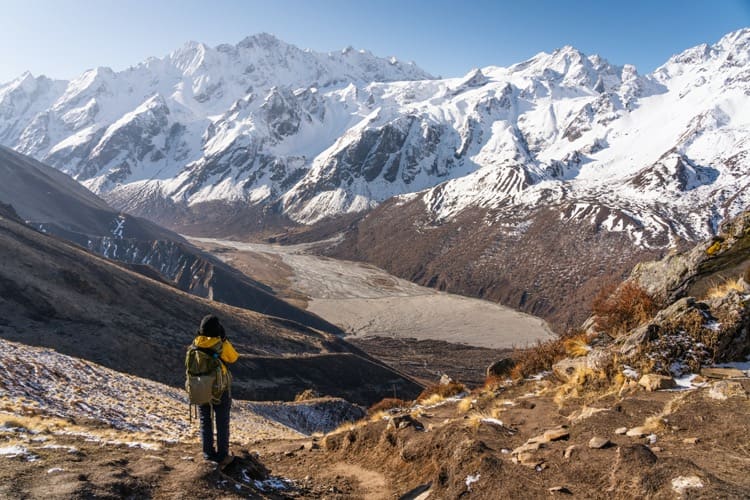
Operators broadly agree that the main trail through Lama Hotel, Langtang Village and Kyanjin Gompa is understood to be intact, based on the latest operator reporting. TAAN has also reported that Langtang/Kyanjin Valley remained safe while the access corridor was affected.
Two caveats:
1. Dhunche to Thulo Syabru to Langtang Valley. Some operators are skipping Syabrubesi and starting from Dhunche or Thulo Syabru. One suggests starting the trek from Thulo Syabru. This depends on Dhunche access, and the Thulo Syabru approach adds trekking days and changes acclimatization.
2. Gosaikunda-side approach from Kathmandu. One operator reports that TAAN has suggested an alternative trekking approach that begins from the Kathmandu side and incorporates Gosaikunda. Confirm current trail conditions and lodging before committing.
3. Switch regions. If you cannot wait, operators are offering Manaslu, Everest and Annapurna alternatives. Check current road conditions for Annapurna first, since that area has its own late-September disruptions.
Not in the normal way. Nepal has not closed tourism nationwide, but the usual road approach to Langtang is closed or restricted, and commercial trekking to the region has largely been paused. Nepal's Tourism Board has advised travelers to postpone trips to the flood-affected corridor. The trekking area itself is reported to be safe, so the barrier is getting there rather than the mountains. Until the road and gateway reopen, treat any Langtang departure as provisional.
A sudden flood came down the Bhote Koshi River from Tibet and struck Rasuwa district. It destroyed roads and bridges between Syabrubesi and Timure toward the Rasuwagadhi border crossing and caused serious damage within Syabrubesi itself. The road between Betrawati and the border was reported destroyed at multiple points. Neighboring districts were also affected, and the loss of life has been severe, with official counts rising sharply in the weeks after. For current figures, check Nepal Police and NDRRMA bulletins rather than relying on a single news report.
According to operators and trekking association reporting, the main trail is understood to be intact. The trail follows the Langtang Khola valley, which is a separate drainage from the flooded Bhote Koshi. That covers the route through Lama Hotel and Langtang Village to Kyanjin Gompa. Two cautions apply. These reports come from operators rather than a formal government trail inspection, and individual sections, bridges or teahouses may still have local damage. Always ask your operator for the latest on-the-ground report.
No. Syabrubesi, the traditional roadhead for Langtang, Gosaikunda and the Tamang Heritage Trail, took direct damage and is heavily restricted. Operators report limited functioning infrastructure, including lodging, and say that restoration work there is tied to the main highway being restored first. Some operators expect access through Syabrubesi to stay closed for a long time. Even when the road reopens, check that the town can host trekkers before assuming a normal start.
As of late September, the road through Trishuli, Betrawati and Dhunche was described as closed for recovery, with a reopening process under way but no confirmed date. The Langtang and Rasuwa corridor was still reported as not accessible a month after the flood. Dhunche has been reported as reachable by an alternative route, and Nepal's transport ministry noted a route that reopened for small, light four-wheeled vehicles. That route should not be assumed to be open to normal trekking transport, so verify it with your operator.
There is no official date. Early operator estimates pointed to late September, and that window has passed. More recent guidance suggests mid-October at the earliest for any improvement in access, with Syabrubesi taking longer. A smaller flood on the same road in July 2025 took 13 days to reopen to one-way traffic, but this event caused far more damage, so a longer timeline is realistic. Treat all dates as estimates that could move in either direction with weather and repair progress.
Possibly, but with flexibility. Peak season runs through October and November, and local communities have strong reasons to reopen quickly. If you hold an October departure, keep the booking but ask for written confirmation of the start point, the vehicle route and the teahouse status. If you have a November departure, your chances are better because there is more time for repairs. In both cases, reconfirm 2 to 3 weeks before you fly. Have a backup plan in another region.
Operators are discussing a few options:
All of these depend on current access, so none is guaranteed.
Safety depends on where and when. The affected corridor still has damaged roads, temporary crossings, landslide and flood risk, and ongoing rescue and relief operations. Authorities have advised postponing travel there, and you should follow that guidance. Weather in the tail of the monsoon can worsen conditions quickly. If you go once access reopens, travel with a licensed guide, start early in the day, carry emergency contacts and avoid river-edge sections after heavy rain.
Most major regions are operating, including Everest, Manaslu and Upper Mustang, according to operator reports. However, a separate wave of flooding and landslides in late September disrupted parts of the Manang road corridor, including Chame, so the Annapurna Circuit needs checking before you commit. Always verify the specific road and trail you plan to use rather than assuming a whole region is fine. Conditions differ by valley and change quickly.
Not automatically. Start by asking your operator what they can offer. Many are providing free rescheduling, alternative itineraries or postponement. Postponing is sensible if your dates are in the next few weeks, since access is not confirmed. If your trip is in late autumn, holding and reconfirming is reasonable. Avoid paying non-refundable extras such as internal flights or lodging until the access picture is clear, and keep a written record of all communications.
Ask these questions in writing:
Clear, specific answers are a good sign.
It depends on your policy and when you bought it. Policies bought after a known event are often limited or exclude it. Read the wording on trek disruption, cancellation, evacuation and altitude cover. Document the event date (26 August 2026), the official advisories and your operator's correspondence. Contact your insurer before cancelling or rebooking, because some require approval first. Make sure your policy covers helicopter evacuation up to your maximum altitude, which is about 4,984 m if you plan the Tserko Ri side trip.
Starting from Dhunche or Thulo Syabru instead of Syabrubesi changes the elevation profile and the number of days. Syabrubesi sits at roughly 1,460 m, while Dhunche and Thulo Syabru are higher, so you begin acclimatizing earlier but may need extra days to reach Kyanjin Gompa (about 3,870 m). Keep the same safe-ascent principles: gradual gains, a rest or acclimatization day, plenty of fluids and no pushing through symptoms of altitude sickness. A longer approach also affects the permit and flight timing, so rebuild the schedule rather than compressing it.
Use official and association sources first:
Operator blogs are useful but vary in accuracy and sometimes contradict each other on dates, so cross-check before making decisions.
Conditions are changing quickly. This update draws on operator reports and news coverage, which sometimes conflict, so verify with your licensed operator before you travel.
Discover more articles that match your interests! Explore these similar blogs packed with insights, tips, and stories to keep you inspired.